
2. Historic context
Marrakesh
The city of Marrakesh was founded in 1070 by a confederation of nomadic Berber tribes living in the territories between the High Atlas Mountains and the Senegal River, giving rise to the Almoravid dynasty. For now, historians believe that it was in 1040, in the oasis of Azougui, in the Mauritanian region of Adrar, that the Berber tribes Lemtouna, Guezoula and Sanhadja came together to give rise to the Almoravid movement, but recent research could locate this meeting rather on the banks of the Senegal River.
Before the creation of Marrakesh, the capital of the region, located at the foot of the mountains and extending over the plain of the Haouz, was Aghmat (today 30 km south of the city of Marrakech). Since the geographical constraints did not allow the extension of the city and that in any case the ambitions of such a dynasty passed by founding its own capital, they decided to create the city of Marrakesh, but they needed a favorable ground "We have chosen a desert place for you, where there are no living beings except gazelles and ostriches, and where only jujube trees and gourds grow" (Kitāb al-bayān al-mughrib fī ākhbār mulūk al -andalus wa'l-maghrib, Ibn Idhari, 1312). This place was limited by the Tensift river and its tributaries, Ourika and Nfiss (with another tributary inside, Issil).
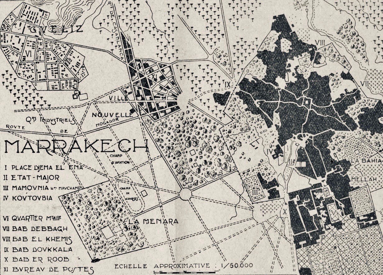
However, Marrakesh cannot be reduced to an urban space like that of the medina inside the ramparts but rather to a vast and complex agricultural space which would contain, among other elements, a city. From this point of view, Marrakesh was an oasis. But what is an oasis? We tend to associate the city of Marrakesh with images of the desert; oases, palm trees, kasbahs, nomads... but these images have been completely trivialised to sell a tourist product, a drift that is transforming the city into a caricature of itself. Here is a quick explanation of what is an oasis shown during the workshop, OASE KASSEL, I co-organized with LE 18 Marrakech during its participation in documenta fifteen in August 2022.
We could summarise that an oasis is an agricultural space organised according to water resources (and its distribution), the nature of the land, its extension and its topography. Lands can have multiple features, but the most usual it is to find small and medium-sized plots intended for the cultivation of cereals surrounded by fruit trees and large trees (generally palm trees but also acacias, poplars, olive trees, etc.). These three elements form a whole, each having a specific functionality but with the same purpose, protection against the sun (heat) and the wind (sand) to ensure food for the inhabitants (and their livestock), building materials (pillars, beams, joists, ceilings, etc.), household utensils, linens, etc.
Depending on the orography, the ksour and kasbahs could be located inside or on the edge of this dense agricultural space. Outside the oasis, there are sometimes large tracts of land that are cultivated only in case of flooding (this can happen once every 5 years), the cultivated wheat is stored and could ensure the production of bread for a family for 5 years (even today these lands are used in the same way).

Extension dedicated to the cultivation of wheat along the valley of Oued Noun between the oases of Fask and Tighmert (Guelmim, Morocco).
Moreover, if the oasis is a place of passage for caravans, there must be a space dedicated to the logistics of trans-Saharan trade, located completely outside of any agricultural plot.
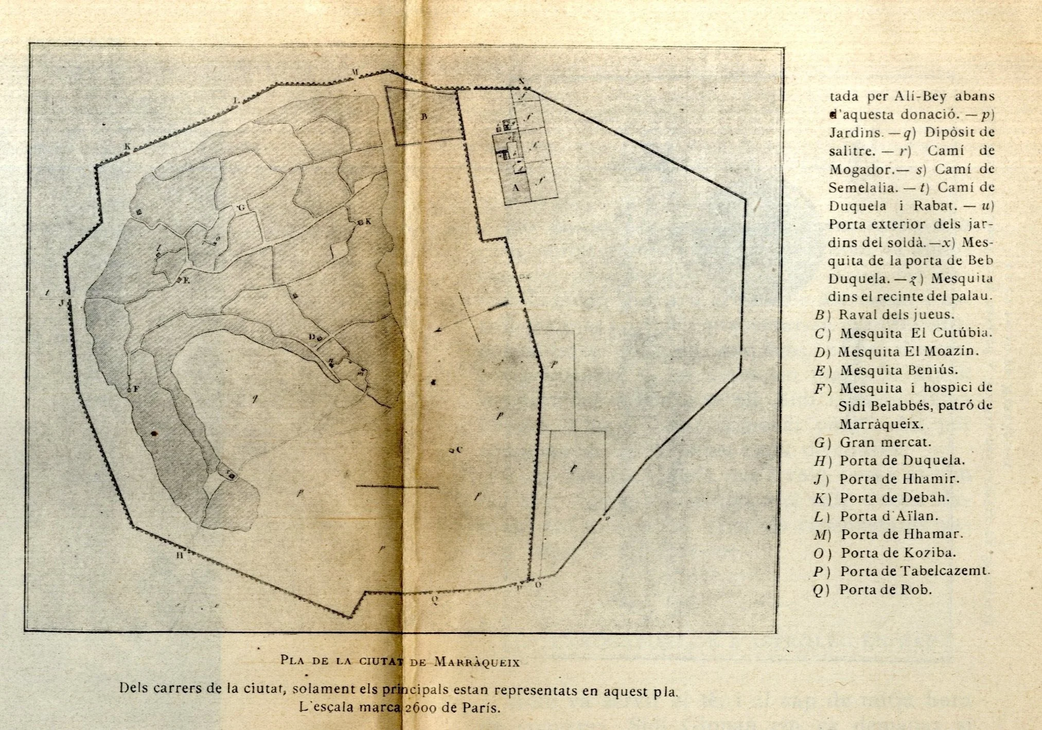
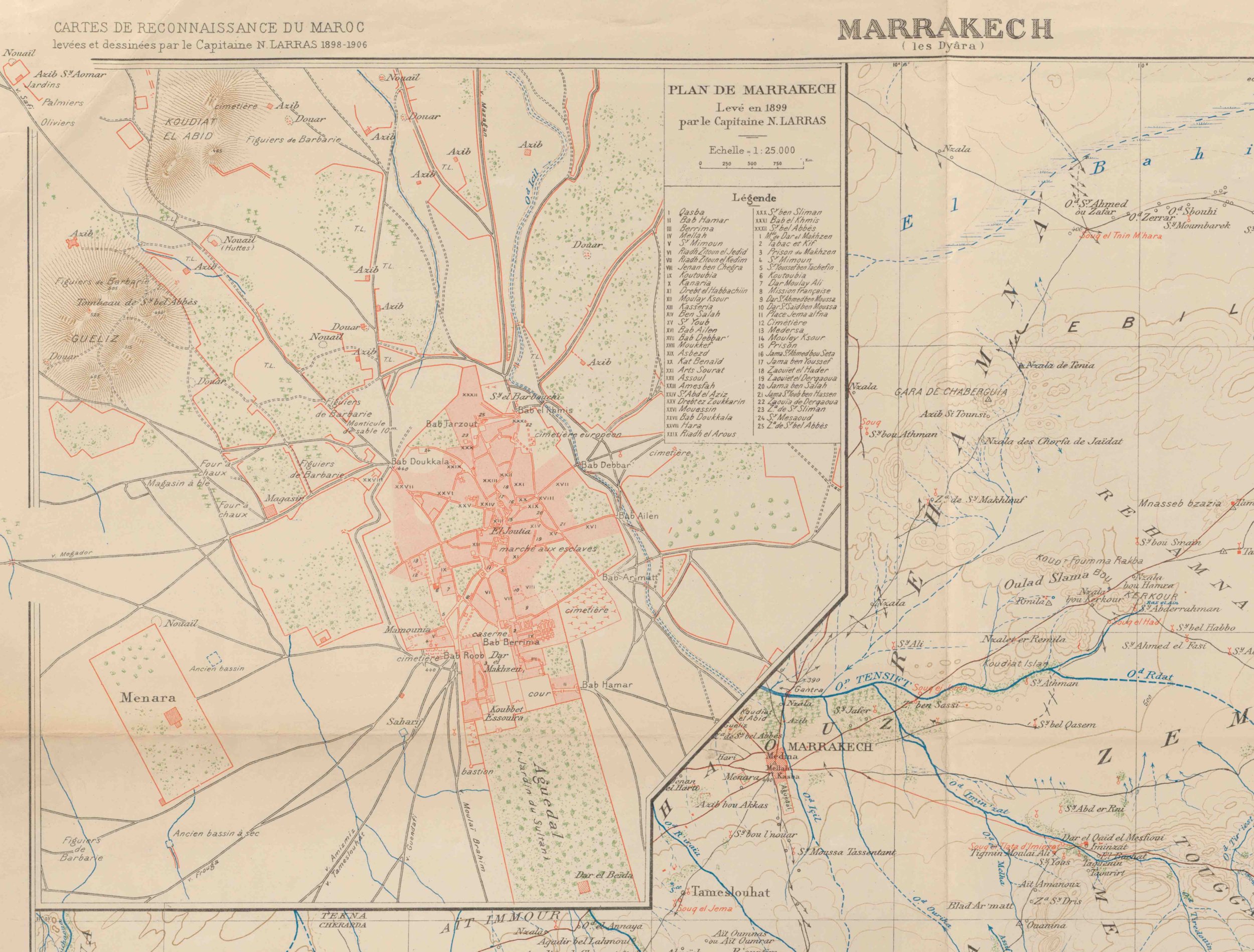
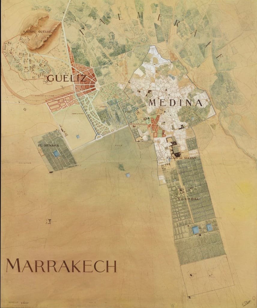
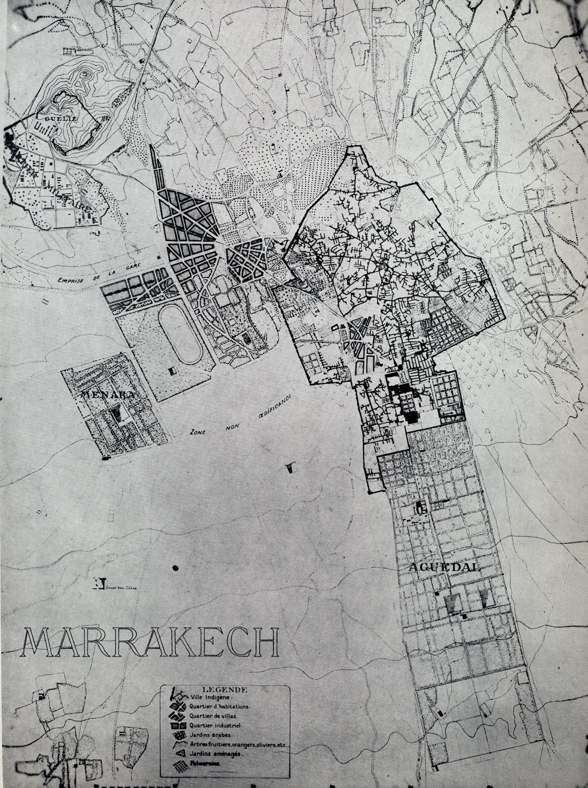
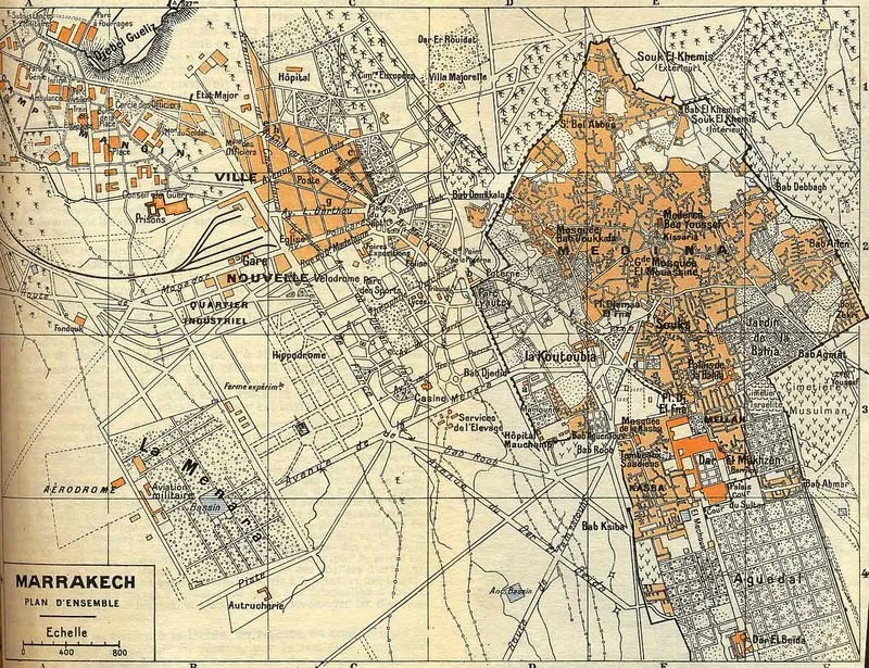
According to the plan of Captain N. Larras of 1899 (with the reservations that a map of this period can raise after 8 centuries of changes and evolutions), we can observe the zoning of the oasis, with the city built inside the ramparts, the surrounding agricultural areas (with intensive and extensive crops that still persist, such as the Menara and Agdal gardens), the situation of the water infrastructures (those visible such as the basins but there were also the underground ones like the khattaras).

Map of Marrakech surveyed in 1899 by Captain N.Larras (source, National Library of Spain)
Historical photos of Guéliz, from the beginning of the Protectorate, show agricultural areas with masses of trees in the surroundings of the medina.
Editor: Tchakerian 1917 (source MANGIN@MARRAKECH)
Editor: Tchakerian 1922 (source MANGIN@MARRAKECH)
Photograher: E. Michel 1912 (source MANGIN@MARRAKECH)
The proof of the existence of agricultural plots around walls is found in the plans of khattaras, a system of underground canals to bring water from the mountains to the “gardens”.

Teheran, Marrakesch und Madrid. Ihre Wasserversorgung mit Hilfe von Qanaten; Eine stadtgeographische Konvergenz auf kulturhistorischer Grundlage (Source: Universitât Bonn)
There are no indications on the caravan market but it is obvious that there must have been, at least, one, either on the way which brings to Ait Taourit well to Taroudant, the two roads which connected the city with the Sahara in crossing the High Atlas Mountains. For me, it is implausible that the caravan market (another thing would be the local markets) could have been located on the Jemaa el-Fna square as some historians propose. In Sijilmasa the market in the city center was a local one, that of the caravans, the Souk Ben Akla, was 5 km outside the city and the oasis. Moreover, it is not possible to return to the square with fully loaded camels by crossing the agricultural plots which leave very narrow paths surrounded by adobe walls which enclose the gardens to prevent the cattle from entering them, as they still do today in the oases. During Qafila Thalitha I was able to see the difficulty of entering an oasis with only two loaded camels.
Perhaps the caravan market could be found at the foot of Mount Gueliz, especially since nearby was the fodder park and the ground was rocky.

Arrived at Tighmert Oasis during Qafila Thalitha
Photographer: Félix 1917 (source MANGIN@MARRAKECH)

Photographer: Fahl 1918 (source MANGIN@MARRAKECH)
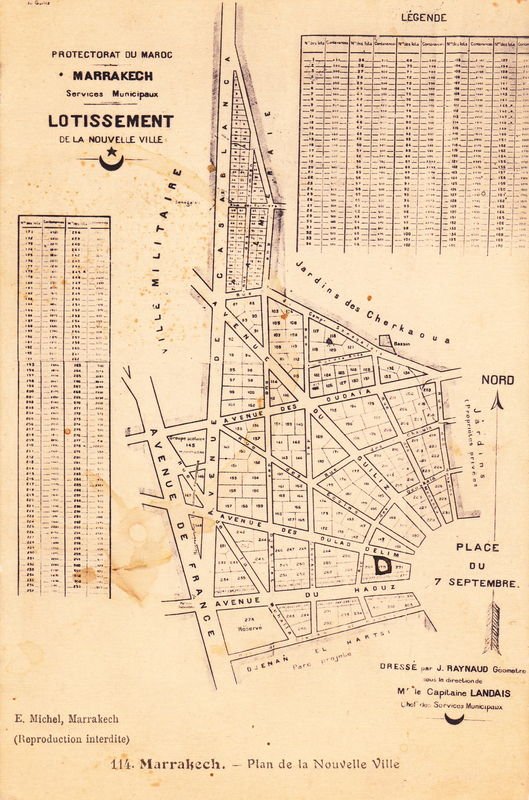
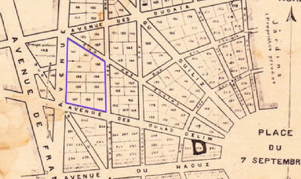
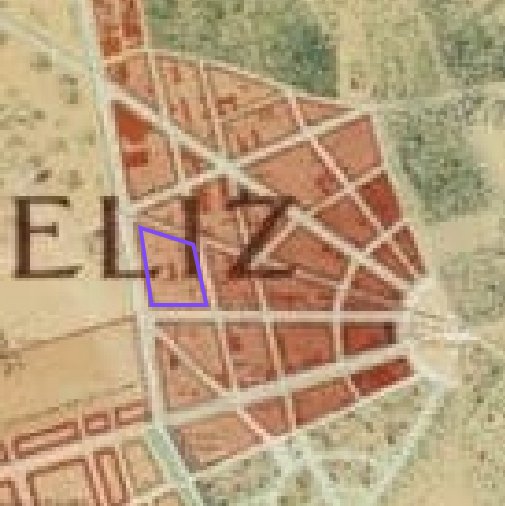
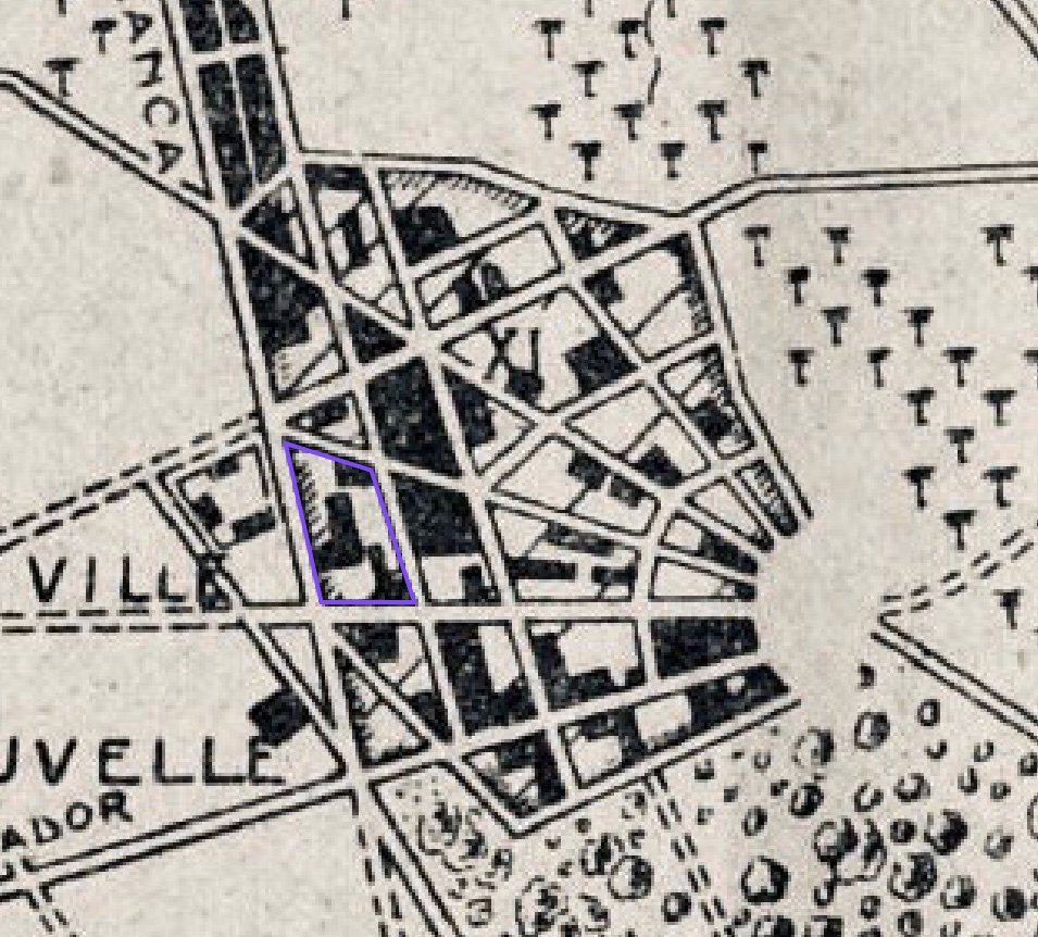
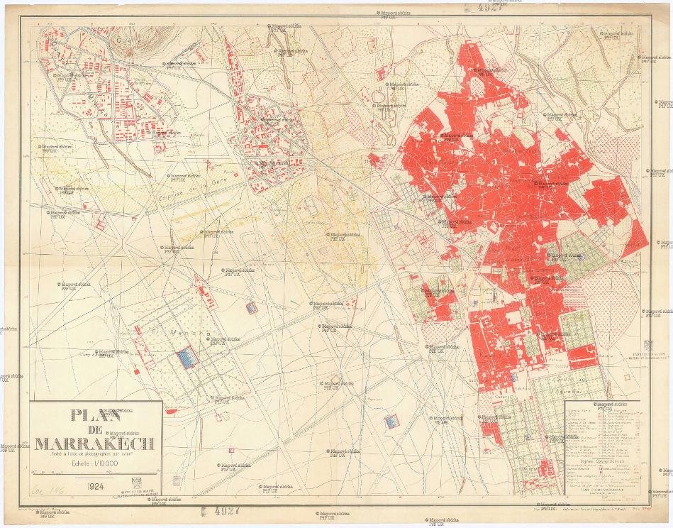
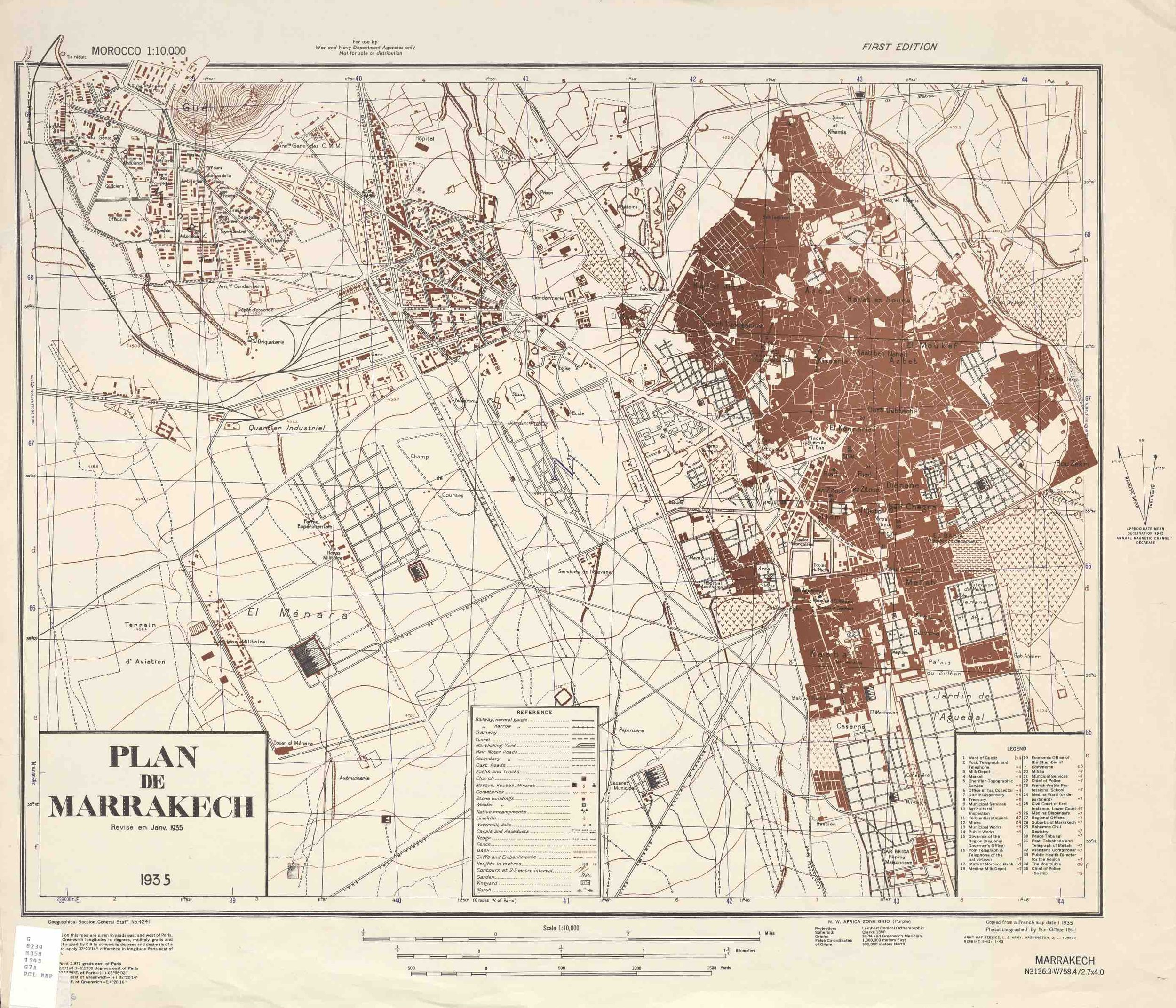
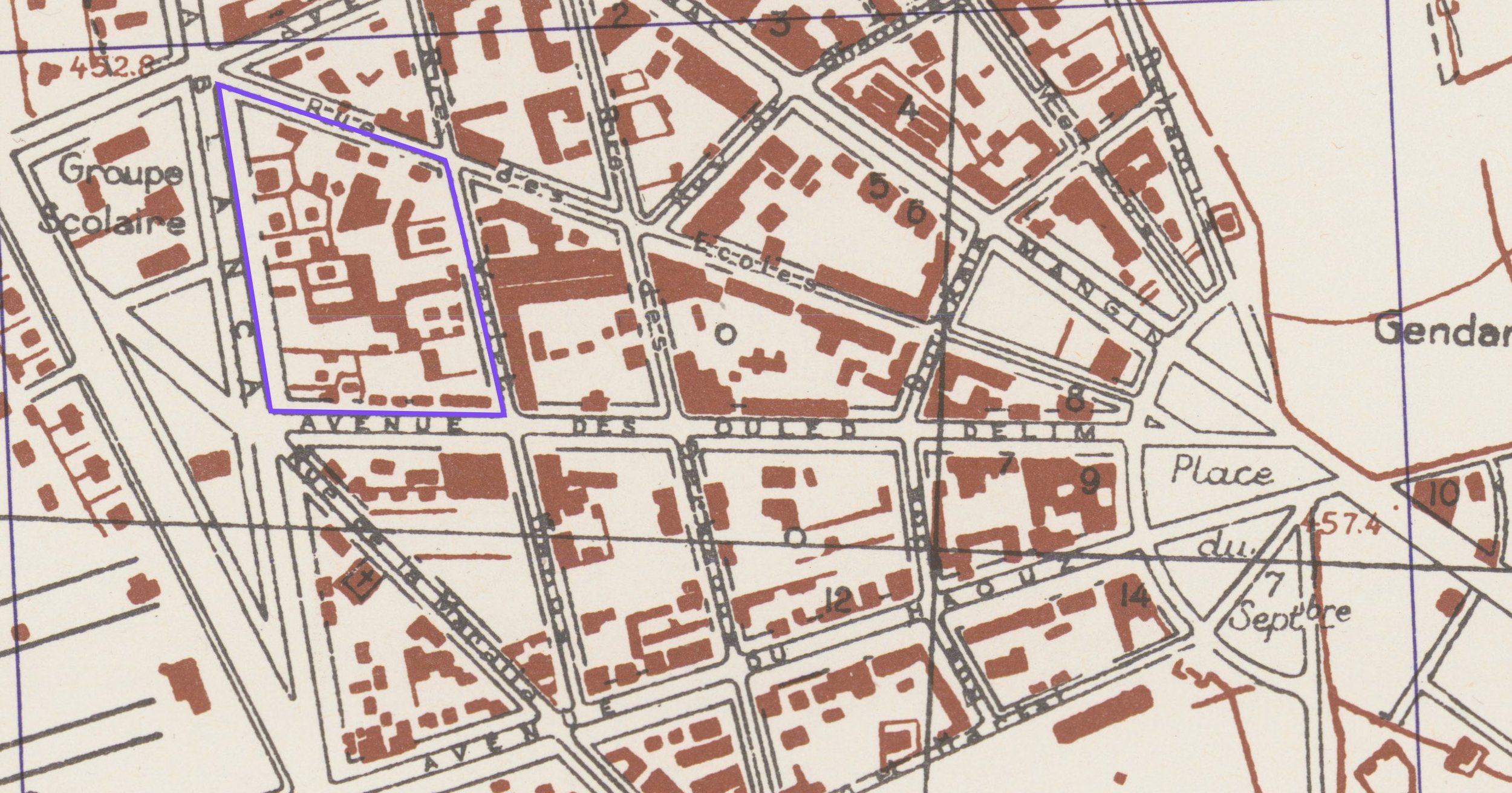
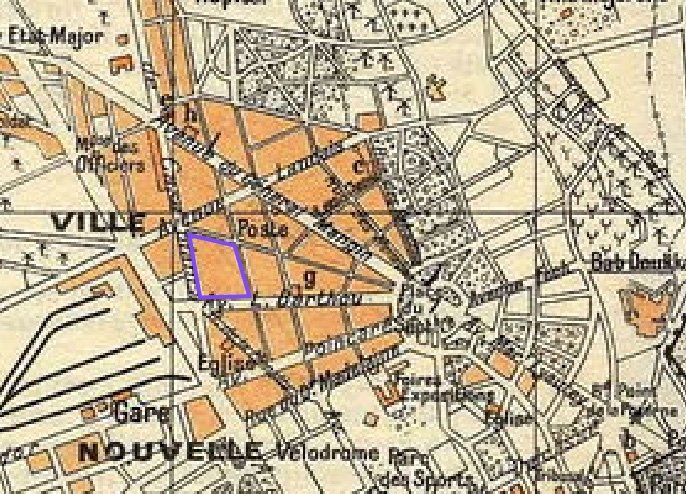
After the Treaty of Fez of March 30, 1912, France established the protectorate and a year later, the municipal services presented a subdivision plan for the new city (Gueliz), drawn by Captain Albert Landais. The development work started that same year and to acquire and build on the lots it was forbidden to uproot the trees unless three new ones were planted for each tree destroyed. This plan will be included in the development plan on which Henri Prost began to work in 1920. On the successive plans we see how the urban block where the Malhoun building is located has not changed within its limits since 1913, even the fragmentation of the plots is very similar to what exists today. On a 1935 plan we could already mention the existence of our building (with reservations since we did not find traces of the project at the Urban Agency). In recent years, the majority of buildings have been replaced by 6-storey apartment buildings when originally there were only three.

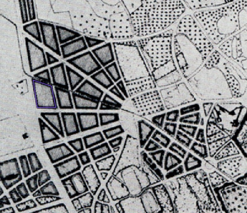
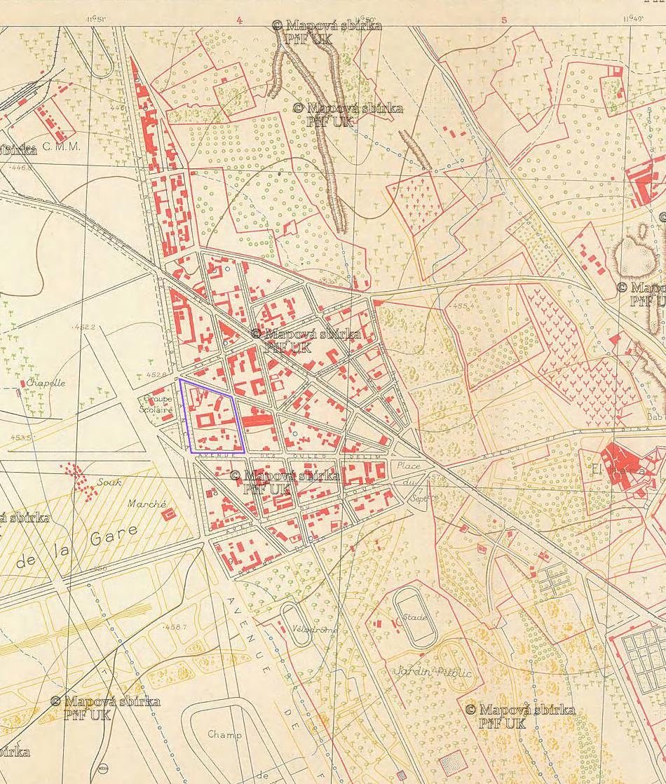
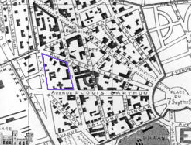
The knowledge acquired and the experiences made in the oases have allowed us to interpret the old plans from a functional and yet agricultural perspective, contrasting them with the way in which the inhabitants still live today in the oases. Thus, we can affirm that the plot on which our project is located, was part of the oasis of Marrakesh and that it was not a vacant lot outside the city. These oasis origins had to be taken into account and integrated into the design of our proposal and into the identity of the future Malhoun Art Space.
Credits texts, photos and drawings: Carlos Pérez Marín