02. Borders cartographies
02. Borders cartographies
In the 9th issue of Transfretana, dedicated to the historical heritage of Ceuta and its management, I wrote the article Ceuta y la Unesco in which, to explain the existence of such extensive historical heritage, I included a map indicating how the border line had been modified throughout history in relation to our city.
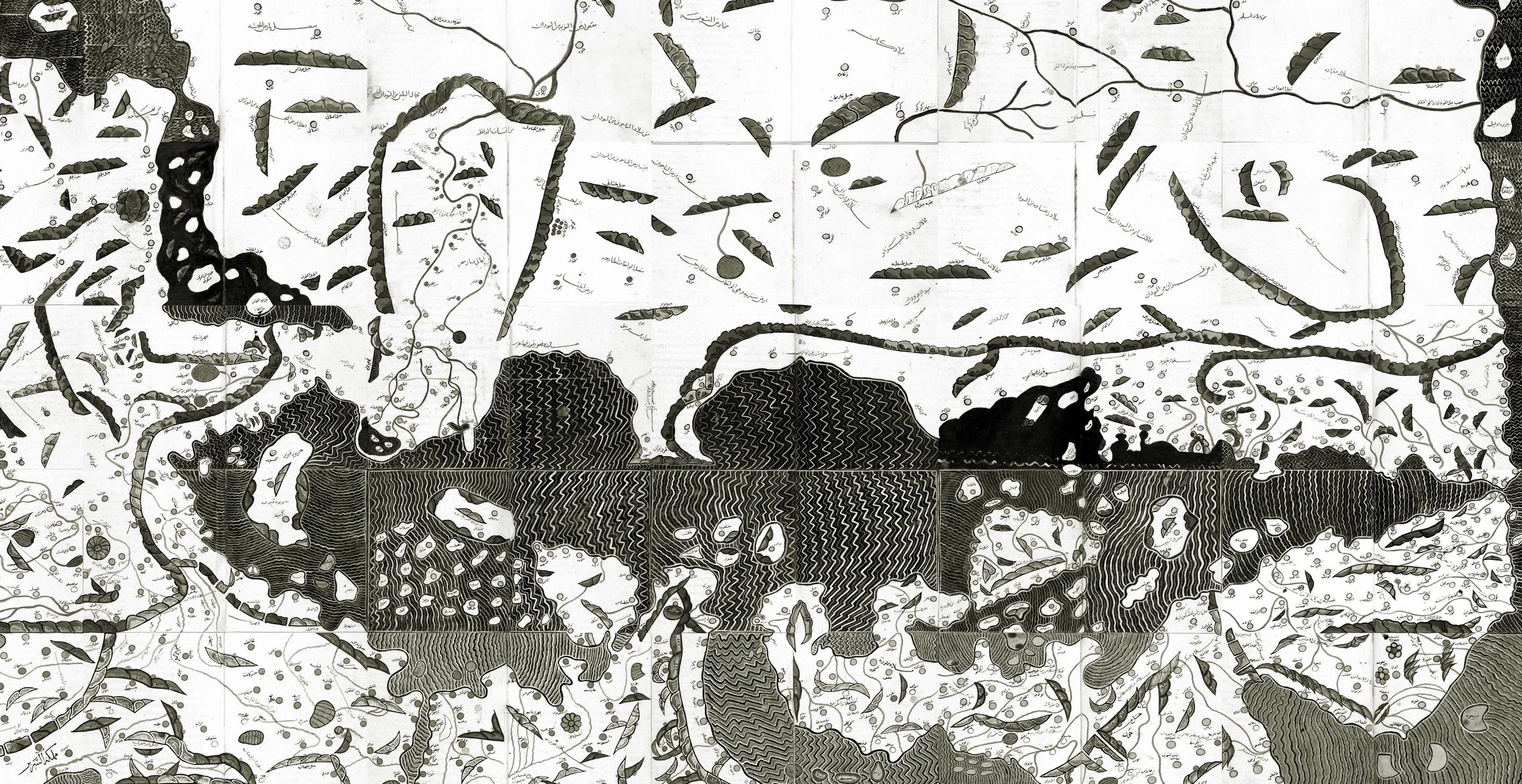
However, this map does not truly show the geographical position that Ceuta occupied during each of the empires, kingdoms, caliphates, sultanates, and governments that have held it, nor how the city gravitated around these centres of power; therefore, I have produced various charts to illustrate the geographical extent of each of the aforementioned powers. There is no intention to exhaustively demonstrate the boundaries; furthermore, although it is a general practice, these were not zones of homogenous occupation. That is to say, different ethno-religious groups could coexist within the same region under a single presumed power, yet with total independence. Thus, for instance, the Muslim dynasties were a heterogeneous collection of confederations, tribes, fractions, and families, with complex alliances and balances, under the authority of a sultan but with constant rivalries and conflicts, as we shall see further on.
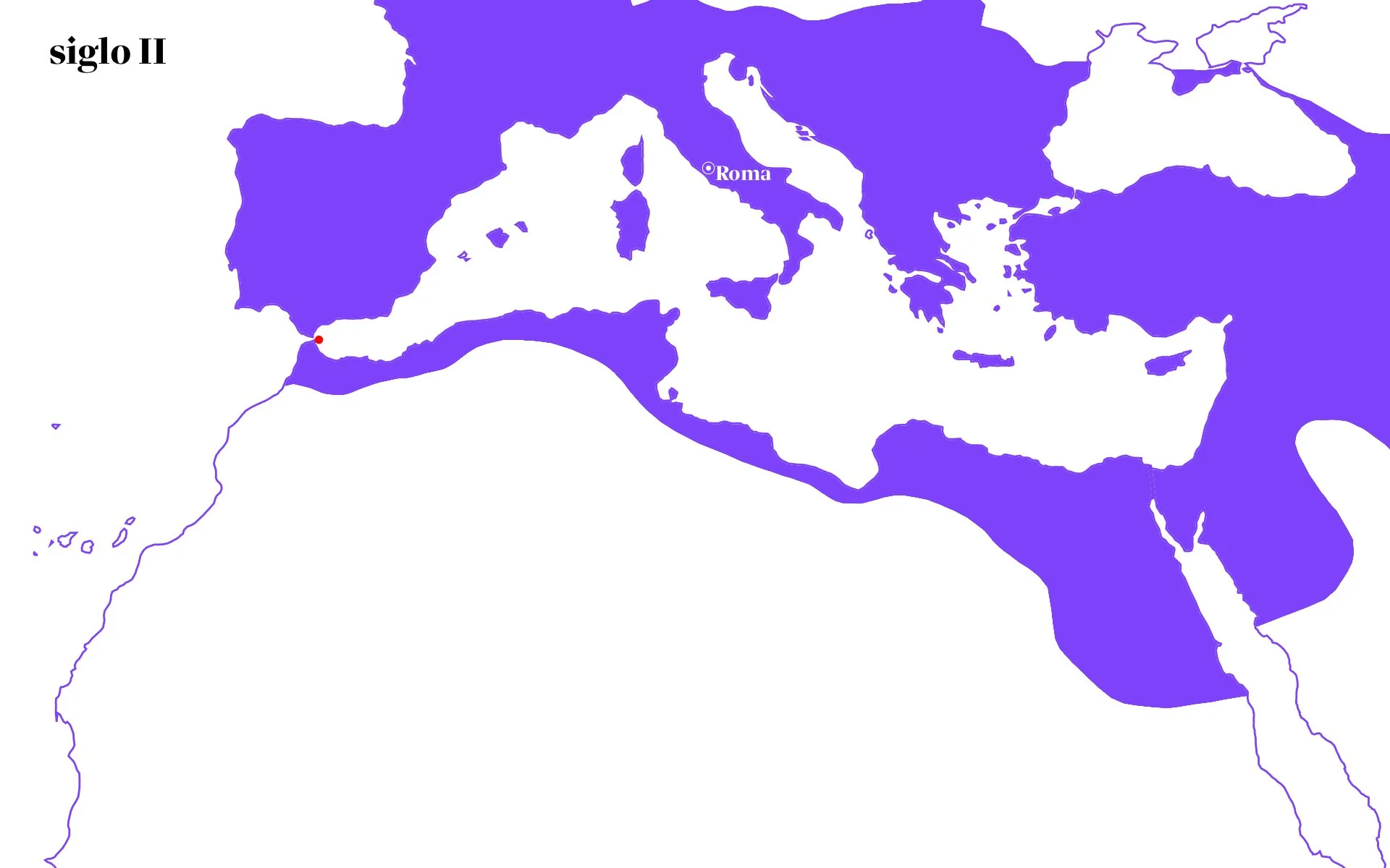
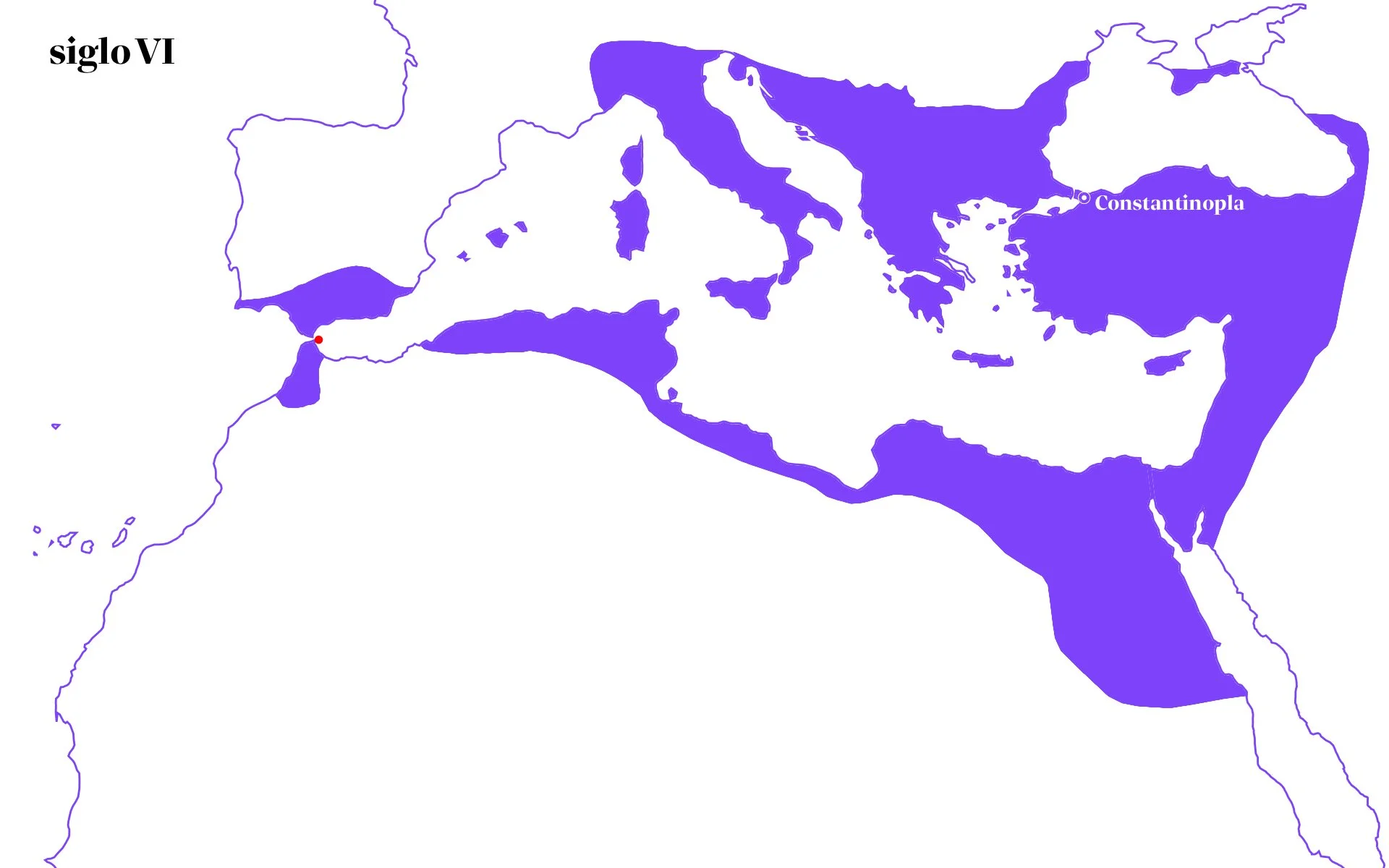
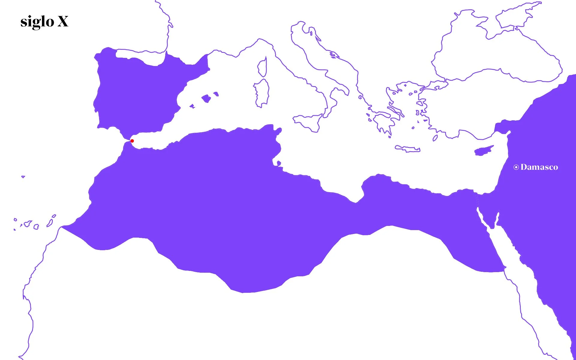
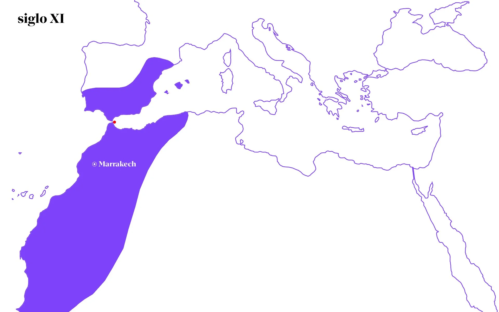
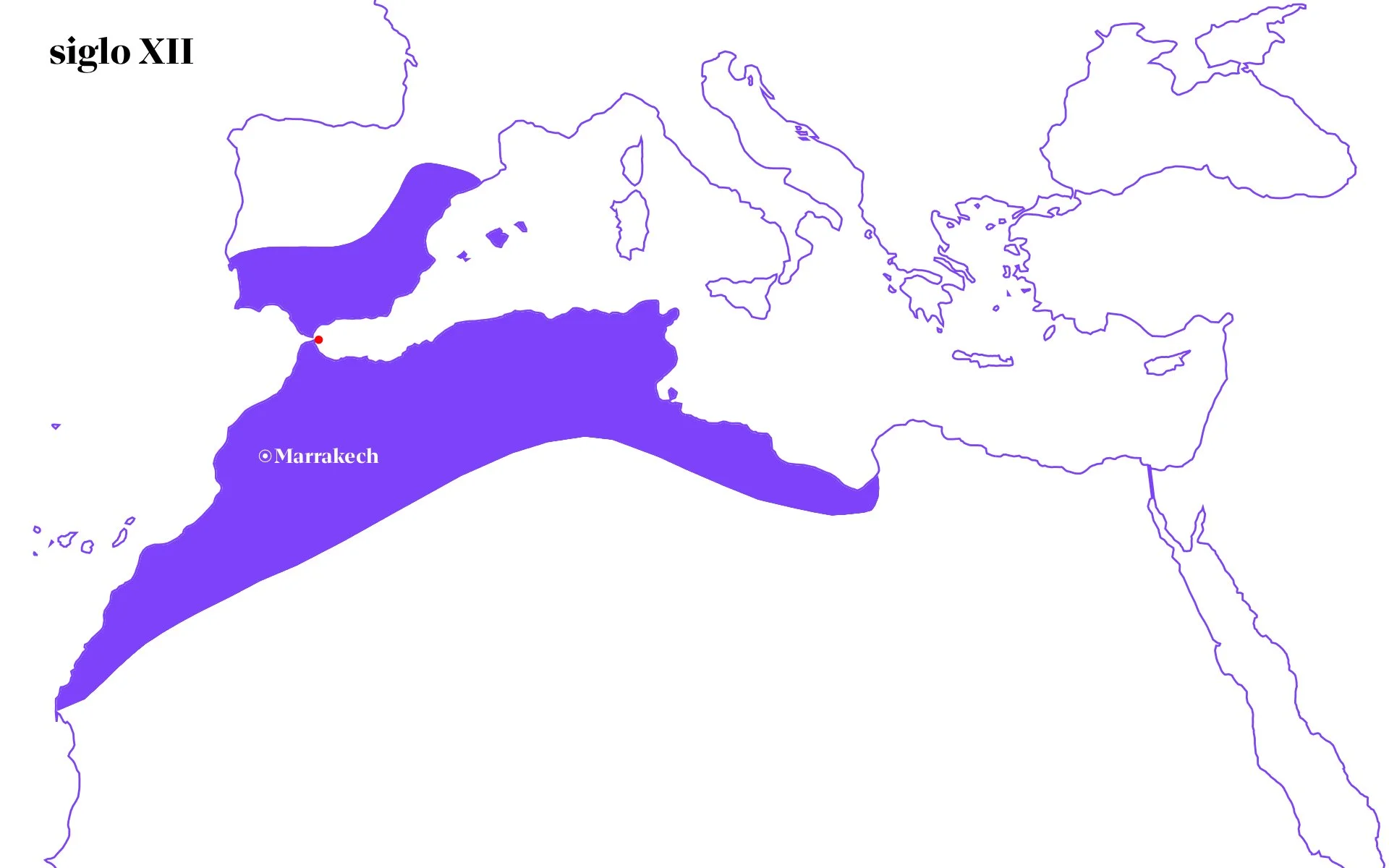
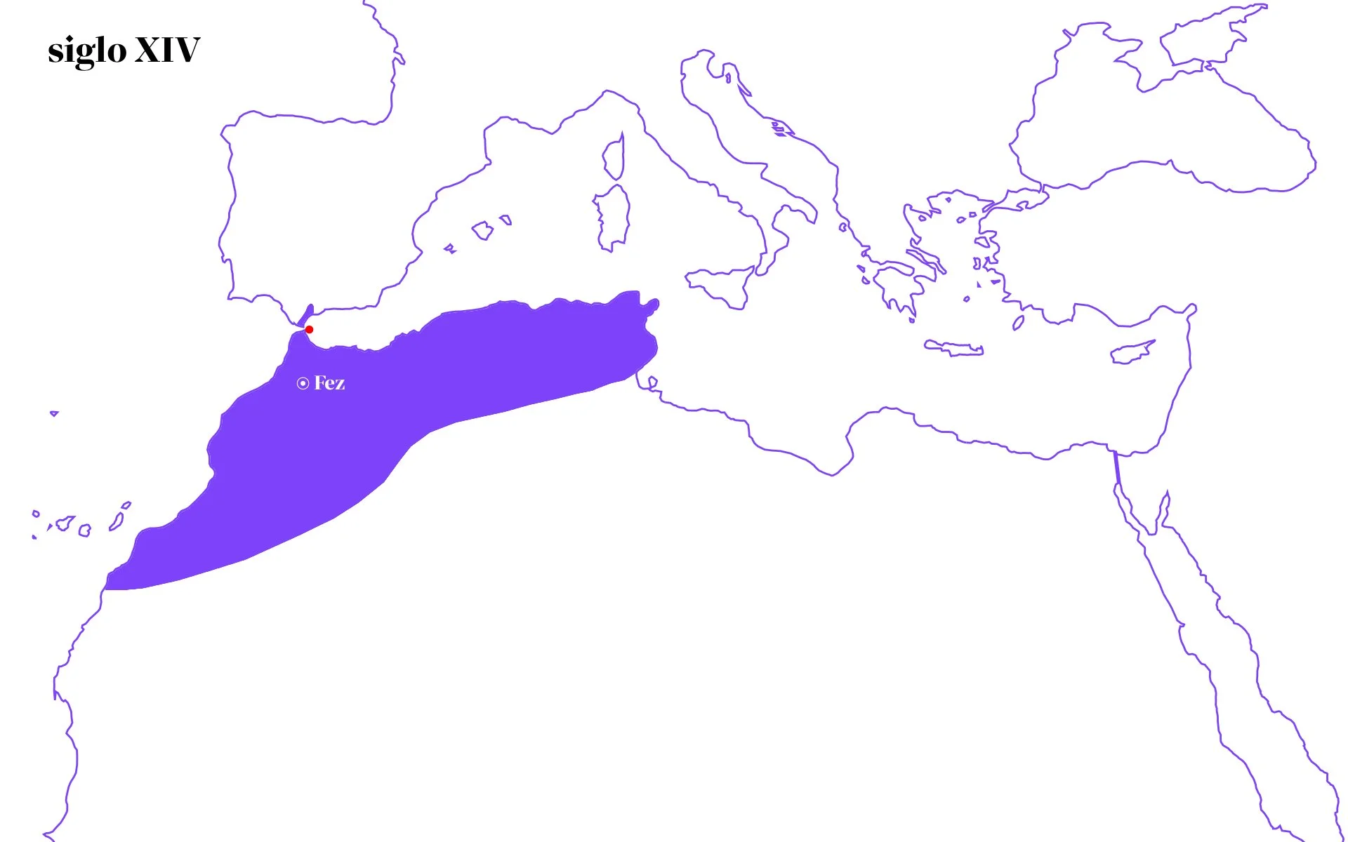
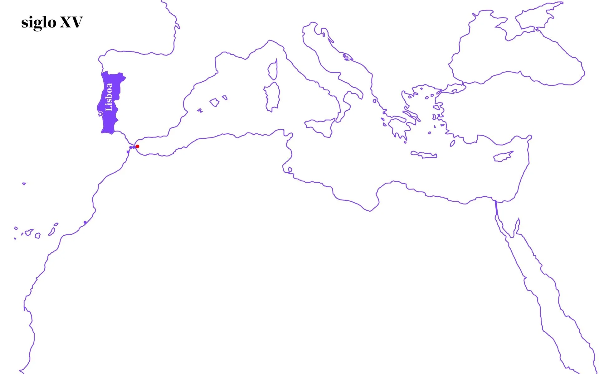
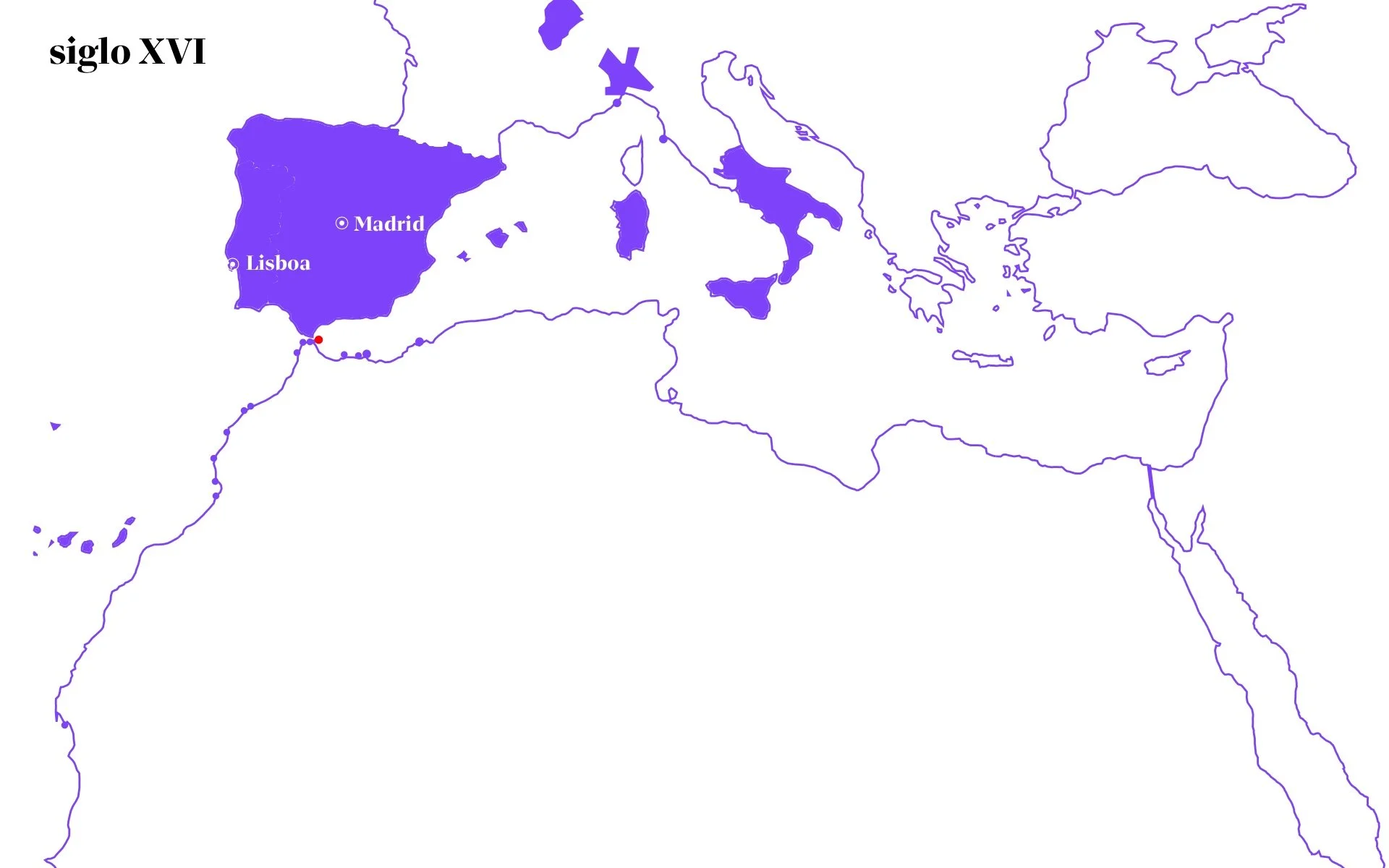
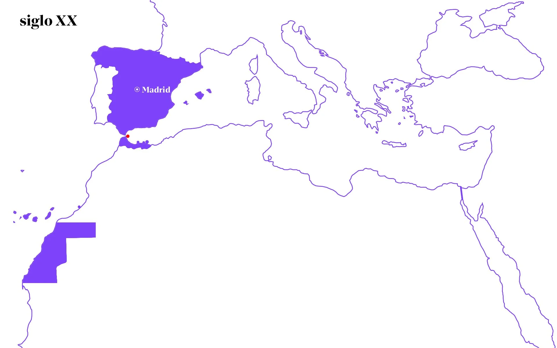
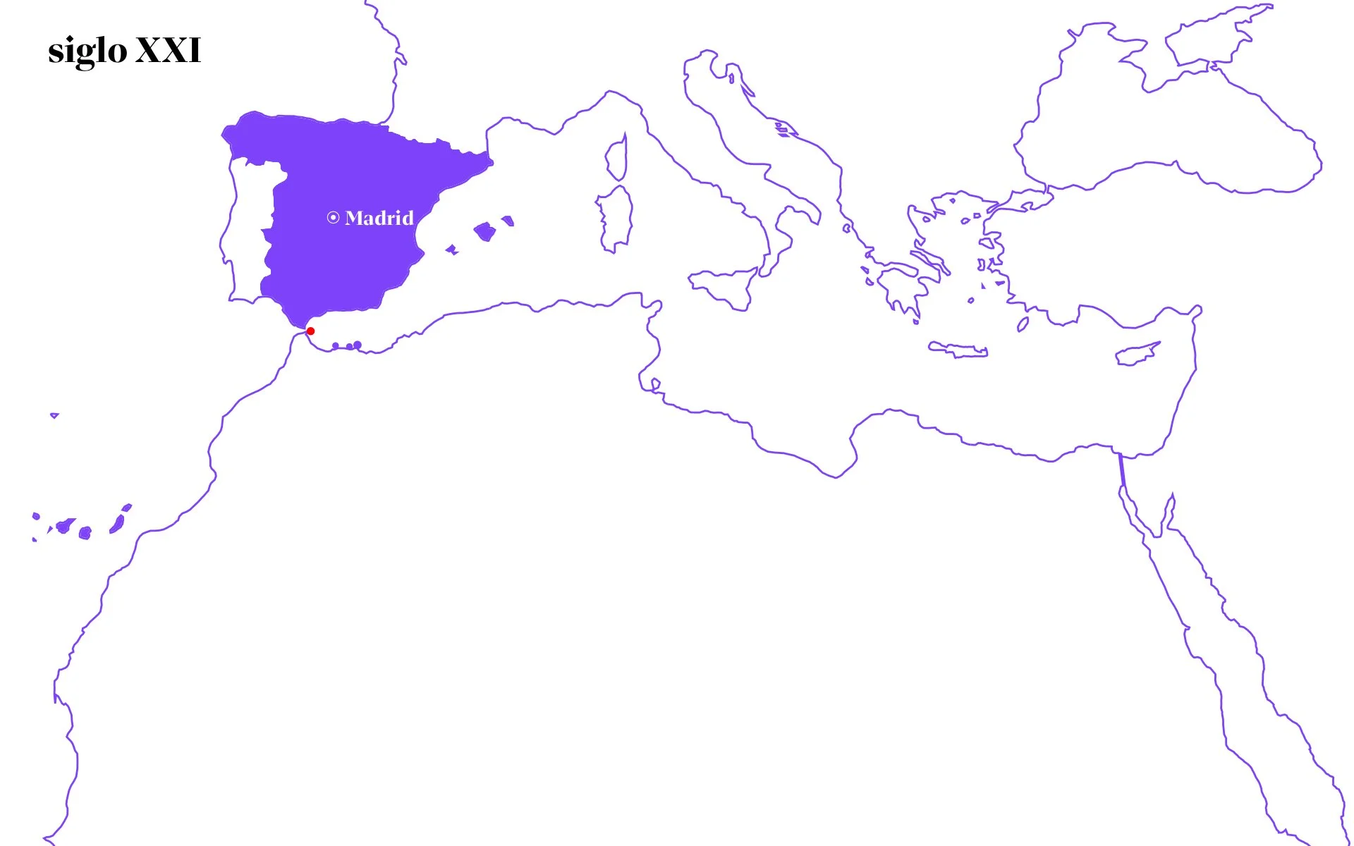
This representation by regions does not fully reflect reality either, as it fails to capture the relationships our city maintained with more distant places, thanks to its integration into a communication network that functioned much like modern transport infrastructure, be it a metro, train, or airline network. This is the case with the Saharan caravan network, which connected the Sahel, the Maghreb, the Middle East, and Southern Europe, establishing a sort of commercial, cultural, social, political, and religious space.
François-Xavier Fauvelle, in the work he coordinated L’Afrique Ancienne, de l’Aksoum au Zimbabwe, explains regarding the division of two peri-Saharan Africas that continents cannot be reduced to individualised geographical spaces or areas of material or immaterial civilisations, but rather to singular historical trajectories unfolding within specific domains unique to each. Having walked over 1,500 km across the Sahara Desert (Project Qafila), following the paths of ancient caravan routes (still useful for nomads but restricted to national regions), I can affirm that covering the 330 km separating Chinguetti from Tidjikja in Mauritania across hamadas and dunes is very much like traversing a major city by metro, except that the stations are water wells and the temporal and spatial scales are completely different.
Therefore, it is not at all surprising that Ouadane and Ceuta were connected in the 11th century and that nomads from Adrar in Mauritania travelled to the Strait to pursue their "university" studies. These routes, which connected the northern and southern shores of the Sahara, still retain a certain relevance today, as stated by sociologist and expert in African migration Eleonora Castagnone, whose field research confirmed that the majority of migrants arriving in the cities of Ceuta and Melilla do so by following routes that coincide with those of the caravans.
What these routes demonstrate — just as Fauvelle argues regarding Egypt's relationship with the African continent (in contrast to the theories of numerous researchers who have historically associated this civilisation with the Middle East, turning their backs on the continent where it holds the largest landmass) — is the link, functioning as an anchor, that these routes have provided for African cities and regions. This is particularly true for those that serve as a connection to another continent, such as the Strait of Gibraltar, the Nile Delta, and the Bab al-Mandab Strait, acting as genuine poles of attraction for human and material flows. In our case, regarding overland routes, Ceuta possessed an umbilical cord connecting us directly to the Sahel, the Middle East, and Southern Europe. If we analyse our city from an African perspective, the perception of our history will yield an image completely different from the current one. In this sense, even the title of this issue of Transfretana could have incorporated some mention of the Africanity of Ceuta and Melilla. Furthermore, if we add maritime connections to the diagram, we then see the links with the Levantine Sea (Phoenicia and the Byzantine Empire), the Tyrrhenian Sea (Roman Empire), the Ligurian Sea (Republic of Genoa), and the Atlantic Ocean (Kingdom of Portugal).
As observed in the previous diagrams, the city has been linked to a multitude of regions and, to a greater or lesser extent, we possess textual sources and above all constructions (fundamentally fortifications) which, when presented chronologically, help us understand the role Ceuta has played over the centuries. They show how, in many cases, it was not merely a small town, but a vital strategic point for controlling the Strait of Gibraltar, with all that this implies, regardless of whether the border lay further north or further south.
Author’s own creation based on various sources:
- Map of the Saharan caravan routes.
- The Great Sea, David Abulafia
- Repertorio de todos los caminos de España (Directory of all the Roads of Spain), Gonzalo Menéndez Pidal
- Early Pilgrimage Routes to Mecca and Medina, Joachim Gierlichs
Credits texts, photos and drawings: Carlos Pérez Marín