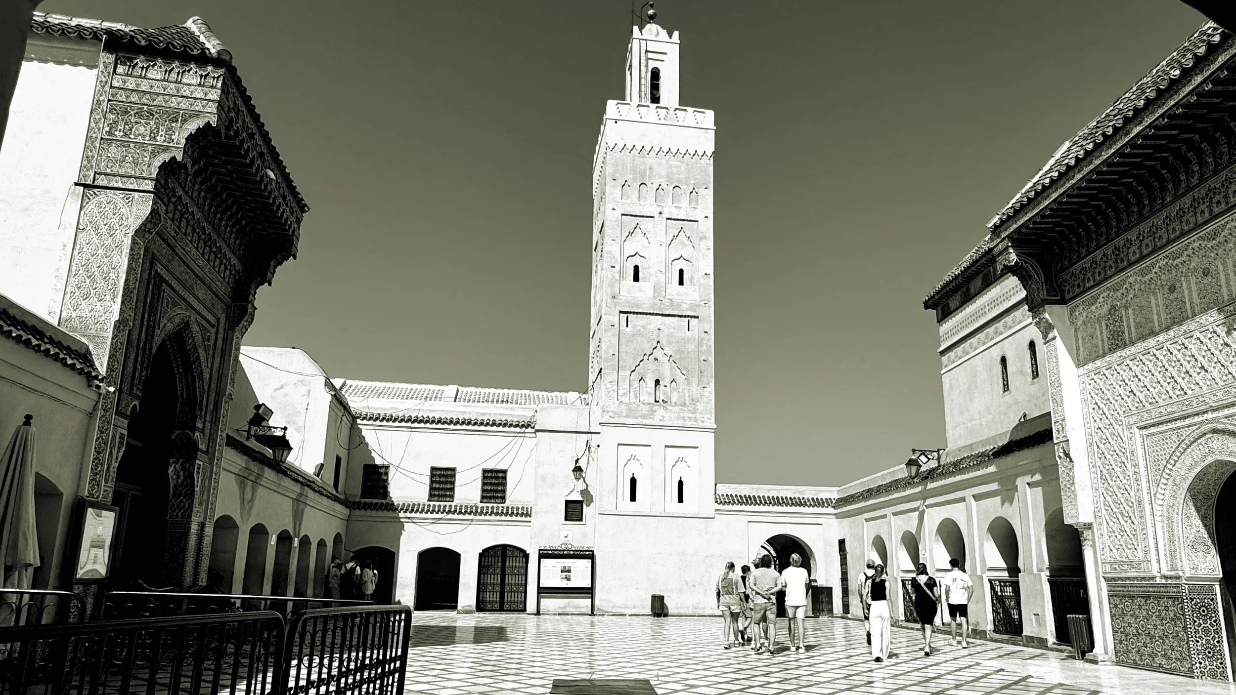
03. Shared heritage in North Africa
03. Shared heritage in North Africa
Let us undertake a brief review of our city's history through the historical heritage that has reached us, and its relationship with the heritage existing in other North African cities across each historical period.
3.01 Prehistory
The first evidence of a human presence in Ceuta is provided by the work carried out at the Benzú Rock Shelter and Cave, conducted by the University of Cádiz and the Autonomous City of Ceuta since 2001. In what is known today as the neighbourhood of Benzú, the presence of hunter-gatherer-shellfish gatherer societies has been confirmed during the Middle Palaeolithic (250,000 years ago). Although they temporarily occupied the hollows provided by the rugged geology of the northern Ceutan coast, subsequent studies on the isthmus — specifically inside the Caliphal Gate — have shown that there were also sedentary societies that manufactured tools. For a broader understanding of this period, our study cannot be confined to the municipal district of Ceuta since, on the one hand, the sea level was 110 metres lower and the coastline differed greatly from today's, reducing the distance between the two continents, and on the other hand, remains of similar societies occupied the entire North African coast as far as Tangier.
Precisely, in the Mugharet el 'Aliya cave in Tangier, in the area known as Cape Spartel, remains were found that were initially attributed to Neanderthals; however, subsequent studies seem to indicate that they actually belong to Homo sapiens. If this study is confirmed, it would represent an advance relative to the results of the work being carried out in Benzú, where so far only tools have been found but no human remains. This fact would be relevant when explaining a possible exceptionality of the Cabililla site, but it would only reinforce the importance of the southern shore of the Strait during prehistory. This should include the prehistoric sites discovered in the bays between Tangier and Ceuta (Belyounech, Marsa, Dalia…) and at the mouths of the rivers (Alyane, Ksar es-Seghir…), as well as the excavations and surveys carried out in the middle of the last century (primarily by Tarradell) and during the more recent work, between 2008 and 2012, of the Archaeological Map of Northern Morocco (directed by Raissouni, Bernal, El Khayari, Ramos, and Zouak).
Specialists on both sides of the Strait hope to prove that the hominin crossing from Africa to Europe did not only occur via the Nile Delta and the Bab al-Mandab Strait, but also across the Strait of Gibraltar. However, it will not be enough to conduct studies independently or in isolation within the aforementioned North African localities; the entire southern shore of the Strait must be considered. If a conclusion is reached one day, it cannot be a scientific milestone exclusive to one country or another, especially bearing in mind that the population of the Cabililla occupied the entire Bay of Benzú, which is today divided between the municipality of Ceuta and that of Belyounech in Morocco.
3.02 Antiquity
3.02.01 Phoenicia
Nothing more is known about the remaining prehistoric periods, and we must advance to Antiquity to find a human presence in Ceuta. Thus, from 1300 BC onwards, the Phoenician civilisation, originating from the far eastern Mediterranean (what is today Syria, Lebanon, Israel, and Palestine), gradually occupied coastal sites along the southern shore of the Mediterranean. Upon reaching the Strait of Gibraltar, they established settlements on both sides of the Strait thanks to its geographical features, founding Barbésula and Cerro del Prado (which would later move to Carteia) on the northern shore; and Kach Kouch, Abyla, Ksar es-Seghir, Tingis, Cotta, Tahaddart, Sania e Torres, and Metrouna… on the southern shore. From this era, we possess a legacy materialised in wall structures (next to the cathedral) and pottery (recovered both from the aforementioned site and the seabed). Their dominance over maritime trade granted them great power, acting as a link (both commercial and cultural) between cities and colonies at both ends of the Mediterranean, and even founding cities like Carthage, which would later become the cradle of Punic civilisation. Such power led them to rival the Greeks themselves for control of the seas. We have also received ceramic remains from the Greeks, in addition to mentions in various literary works and scientific treatises (Pseudo-Scylax, Strabo, Diodorus Siculus, Ptolemy…), which referred to the city as Hepta Adelphoi. Ultimately, from the 7th century BC, the city formed part of a network of localities (rather than territories) that spanned the Mediterranean from east to west along its southern flank, continuing along the Atlantic coast where they founded other cities such as Asilah, Lixus (considered by archaeologists to be the most important Phoenician port on the Atlantic), Moulay Bousselham, Banasa, Chellah, and Essaouira. This last city would be the southernmost location, although research so far indicates that this site was only used on a seasonal basis.
Ceuta became part of the Punic civilisation between the 4th and 2nd centuries BC, as evidenced by the recovered amphorae, but to date, no remains of a settlement have been found (as is the case with the tombs in Tangier). However, the fact that Carthage not only maintained the cities and colonies founded by the Phoenicians but also expanded them by reinforcing its military and commercial power on the African coast, on the main Mediterranean islands (Sicily, Sardinia, Corsica, the Balearics...), and in inland territories (the Iberian Peninsula, North Africa, the Middle East), led our city to intensify its relations with other ports. This reached the point where salted fish products were sold in Corinth (Greece), once again demonstrating the commercial connections between opposite ends of the Mediterranean.
In Tangier, Phoenician-Punic sites are more numerous, perhaps due to the geomorphological characteristics and length of its coastline. Thus, remains have been discovered in Magogha es-Sghira, Cape Spartel, Ras Achakar, Ghandouri, Dbeila, Malabata, Marshan, Mries, Mers, and the Ferme Petit Bois. It must not be forgotten that it is during this era, and especially when Carthage became the capital of the Punic State, that a true colonisation of the shores of the Strait took place, at least on the African side.
3.02.02 Rome
Following the Punic Wars, with the demise of the Carthaginian Empire, Ceuta became part of the Kingdom of Mauretania (which had always maintained relations with both the Phoenicians and the Carthaginians), until the arrival of the Roman Empire in AD 44, when it was incorporated into the province of Mauretania Tingitana. Subsequently, in the 4th century, the province became part of Hispania Ulterior as Hispania Transfretana, turning into a province straddling Africa and Europe. During this period, it was no longer a coastal occupation but rather vast territories, within which cities, industries and infrastructure were developed. Over time, the city consolidated its status within the administrative organisation of the Roman Empire, acquiring the status of a Roman municipium in the 2nd century. Although no urban layout has been found to confirm the existence of a formal city, archaeological excavations do show the presence of a fortification on the isthmus and a major fish-salting industry (with remains of vats and amphorae). This placed the city as yet another element within the industrial complex surrounding the fishing industry of the Strait of Gibraltar and the Atlantic coasts of Portugal and Morocco, where the product most coveted by Rome was garum to such an extent that merchants from Ceuta sold it in the markets of the empire's capital. Even if there was no city as such (at least nothing has been found so far), it was not a mere anchorage either; otherwise, the early Christian basilica would not have been built (between the 4th and 5th centuries) to bury its citizens, as evidenced by the remains of the castellum found inside the Royal Wall (Muralla Real), the necropolis, the late Roman basilica built over it, the Puertas del Campo burial site, the Arcos Quebrados aqueduct, the place of worship dedicated to Isis, the fish-salting vats, and the amphorae on the isthmus...
In any case, Ceuta formed part of a coastal industrial network alongside other sites that today belong to Morocco, such as Marsa, Alcazarseguer, Cotta, Tahaddart, Lixus, Sania e Torres, and Metrouna. However, all of them were dependent on the societas or companies of Baetica, which bore the brunt of the fish-salting exports. Nevertheless, the main city of the province was Tingis (Tangier), the capital of Mauretania Tingitana and the apex of a triangle where much of the power was concentrated, alongside Volubilis and Sala Colonia (Chellah in Rabat). The execution of infrastructure and cities in this area allowed for the large-scale exploitation of its agricultural resources, adding this new industry to the existing marine related one on the coast.
3.03 Late Antiquity
3.03.01 Byzantium
At the beginning of the 5th century, the Vandals began their expansion from their region of origin (what would today be the German and Polish coasts of the Baltic Sea) towards the south, crossing Roman borders and reaching North Africa — taking first Tangier, then Ceuta and even Volubilis (near Meknes) — until finally establishing their capital in Carthage, from where they imposed a new order on the western Mediterranean thanks to their control over the Balearic Islands, Corsica, Sicily and Sardinia. Such power enabled them to sack Rome and, shortly afterwards, negotiate a peace agreement with Byzantium. There are no notable remains from the Vandal period in the regions of North Africa close to the Strait, mainly because these were raids rather than a continuous occupation; nevertheless, the entire fish-salting industry around the Strait continued to operate, as did its ports, at least until they were defeated in the 6th century by the Byzantines.
Emperor Justinian I, as part of his strategy to reunite the Western and Eastern Roman Empires (Recuperatio Imperii), proposed initiating the 'reconquest' from opposite poles: on the one hand from Constantinople itself; on the other from the Iberian Peninsula, using the city of Septem (Ceuta) as a logistical base to supply cities such as Malaca (Málaga) and Carthago Nova (Cartagena). The importance of Ceuta to Byzantium was made evident by the existence of a Byzantine fortification reinforcing an earlier Roman one. We are talking about a wall that in some places exceeds 7 metres in height and which could possibly (pending confirmation at the Coraza bastion) exceed 200 metres in length, making it the most significant Byzantine structure in the area of the Strait (Del istmo a las murallas reales: Un desafío para la arqueología preislámica de Septem ss. I-VII d.C., Villada, Casasola).
Although some sources also mention the capture of Tangier by the Byzantine army, no archaeological evidence has been found of a continuous occupation or of the execution of fortification works; in fact, recent research (Carta arqueológica del norte de Marruecos) points to a total absence of Byzantine remains beyond the city of Ceuta on the African side. This finding explains why the city of Ceuta depended directly on Constantinople, at the eastern end of the Mediterranean, rather than on a local or regional power.
Despite managing to occupy a significant strip of land in the southern and south-eastern parts of the Peninsula, it is not clear whether the Visigoths occupied the city — at least there is no archaeological evidence — meaning the Byzantines would have remained in the city until the arrival of the Arabs.
3.04 Middle Age
The Visigothic presence did not mean the founding of new cities, but rather the utilisation of pre-existing towns and buildings. With the arrival of Muslim troops at the Strait, major infrastructure would gradually be developed on both shores, alongside the refounding or new occupation of abandoned urban spaces.
3.04.01 Umayyads
At the end of the 7th century, the initial military incursions of the Umayyad Caliphate of Damascus into North Africa began. These were led by the governor of Ifriqiya (modern-day Tunisia), who, in addition to dealing with the Visigothic cities of Ceuta and Tangier, also had to contend, in the first instance, with the local Berber tribes. Following the agreement with Count Julian, the city was permanently occupied in the year 711 and used alongside Alcazarseguer and Tangier as a base for the "conquest" of the Iberian Peninsula.
Given the heterogeneous nature of the Umayyad troops, which included numerous North African Berber tribes within their ranks, these tribes took advantage of the absence of units from Syria to seize the city of Ceuta. They initiated a series of actions aimed at achieving independence from the influence of Damascus, which was eventually attained at the end of the 8th century with the establishment of the Idrisid dynasty (whose founder had fled Baghdad to settle in Morocco). The Idrisids came to occupy a territory bounded to the east by modern-day Algeria and extending south to the foothills of the Anti-Atlas (specifically the city of Tamdult near Akka). After three decades, the kingdom was divided and weakened until the early 10th century. By then, with the Caliphate of Córdoba already established in Al-Andalus, both Ceuta and Tangier were captured and fortified for the precise purpose of obstructing the crossing of the Strait by the numerous North African tribes hostile to the Caliphate, and, above all, to protect against attacks from the Fatimid Caliphate (which originated in Tunisia but established its capital in Cairo). During a period of dispute for hegemony in the Arab world between the Umayyad and Fatimid Caliphates, Ceuta and Tangier became the primary line of defence for the former. They fulfilled their role successfully as they were never captured, allowing the Umayyads to maintain control of the Strait from both the North African ports (Ceuta, Asilah, Tangier, and Melilla) and those of the Peninsula (Tarifa, Almería, Almuñécar, Málaga, and Algeciras).
Our city became an advanced Umayyad (Córdoban) outpost in Africa, as evidenced by the walls built during that century. These fortifications were of such magnitude that they maintained their defensive function until the 16th century, as will be seen later. The significance of these walls lies in the fact that it was not merely the capture of Ceuta at stake, but that of the Caliphate of Córdoba itself; if Ceuta fell, the Caliphate fell. Similarly, one could assert the importance attached to Tangier by Córdoba; the estimated area of its citadel (alcazaba) is thought to be among the largest built by the Caliphate. However, the lack of archaeological studies on the existing walls makes it difficult to truly gauge their original extent (also because the British demolished the city's fortifications with gunpowder when they abandoned it in the 17th century).
Following the disintegration of the Caliphate of Córdoba into Taifa kingdoms, Ceuta was incorporated into the Taifa of Málaga, and subsequently into that of Granada (after the latter conquered Málaga), until a Berber tribe from the Barghawata seized the city and founded the Taifa of Ceuta, backed to some extent by the Abbasids of Baghdad.
3.04.02 Almoravids
The instability brought about by the emergence of the Taifa kingdoms came to an end with the rise of the Almoravid dynasty in the 11th century. Their origin lay in a confederation of nomadic tribes (Sanhaja, Lamtuna, and Jazula) whose area of movement spanned from the High Atlas Mountains (in Morocco) to the Senegal River (in Mauritania), although their roots are located in Algeria and Senegal. Advancing from the Sahara Desert, they conquered existing cities and founded new ones (such as Marrakesh) until they reached the north, capturing Ceuta in 1084 and subsequently the rest of the territories associated with the Taifas on the Peninsula. This dynasty came to control a territory stretching between Mauritania and Mali to the south, Tlemcen in Algeria to the west, and the southern half of the Iberian Peninsula. The power of this dynasty, however, did not materialise into a significant architectural or archaeological legacy in our city, unless it is confirmed one day that the walls of Mount Hacho were built by them, as recorded by al-Ansari in his 14th century description of the city. Nevertheless, their importance can be demonstrated by the prominence achieved by four individuals from Ceuta, beginning with the second emir, Ali ibn Yusuf, who was born in Ceuta, alongside the geographer al-Idrisi, the jurist (qadi) Ayyad, and Sidi Bel Abbas. The latter two became patron saints of the city of Marrakesh.
The historical importance of Ceuta contrasts with that of Tangier, where the lack of archaeological studies prevents the identification of both visible and buried 11th century structural elements. However, it is highly probable that renovation and reinforcement works were carried out on the walls, alongside the construction of new buildings in the city; yet, for the time being, the existence of an Almoravid material heritage cannot be definitively asserted.
Undoubtedly, the city boasting the greatest Almoravid heritage is Marrakesh, not only because it was founded by the dynasty in 1070, but also because they created an oasis containing a medina. Despite all the transformations undergone in subsequent centuries, the structure of the oasis, its hydrological system, and several of its constructions are still recognisable (sections of the walls, remnants of the al-Hajar fortress, the ablution pavilion dome (qubba), and the layout of many streets within the medina). A significant hydraulic heritage also remains in Rissani, built for the water management of the city of Sijilmasa and its surrounding oases (The Last Civilized Place: Sijilmasa and Its Saharan Destiny, Ronald A. Messier and James A. Miller).
Perhaps the most representative heritage consists of the fortifications built at the primary crossroads of the caravan routes, stretching from Ouadane in Mauritania to Ceuta: Ouadane and Azougui in the Adrar region of Mauritania; Agwidir (Asrir, Guelmim), Dar Sultan (Taghajijt, Guelmim), Tidri (Zagora), Tazagourt (Zagora), Aufilal (Errachidia), Jebel Mudawwar (Errachidia), Tasghimout (Marrakesh), Amergo (Taounate), and the Kasbah of the Udayas (Rabat) in Morocco.
These facts and the bequeathed heritage allow us to assert that Ceuta was directly connected not only to the Almoravid capital, Marrakesh, but also to Ouadane. This is evidenced by the fact that two of the three founders of the city in the Adrar region lived in Ceuta to pursue studies under qadi Ayyad before returning to their homeland to found that very city in 1146 (Ouadane et Chinguetti. Deux villes anciennes de Mauritanie, Abdel Wedoud Ould Cheikh and Bruno Lamarche), thereby turning our city into an academic benchmark and a focal point of attraction across the whole of North Africa.
3.04.03 Almohads
In the mid-12th century, the Almoravids had to confront a new dynasty, the Almohads (originating from territories south of the High Atlas Mountains in the Al-Haouz province), who would eventually occupy almost the exact same territories. They reduced them in the south to the pre-Saharan regions but expanded them across North Africa as far as Libya. In Ceuta, two rebellions led by qadi Ayyad temporarily interrupted Almohad dominance over the city. Once they permanently secured control, they turned Ceuta into the foremost city of the Strait, within a province comprised of other cities such as Tangier, Algeciras, and Málaga. The creation of this province, straddling two continents and sharing the Strait of Gibraltar as common territory (just as had occurred with Roman Hispania Transfretana), is particularly interesting. Undoubtedly, the aim was to exert greater control over the maritime passage between both shores, just as the Umayyads had done two centuries earlier, and even much earlier, when the Phoenicians and Romans occupied the maritime territory of the Strait of Gibraltar. The Strait was (and remains) fundamental to maintaining power on both sides of it.
In Tangier, the defensive structures of the citadel (alcazaba) were renovated, but the rise of Alcazarseguer reduced the prominence and importance of the Tangier port due to the saturation of the shipping lane between Ceuta and Algeciras. The Almohads decided to relocate military logistics to the ports of Alcazarseguer and Tarifa, establishing a new shipping lane across the Strait.
In Ceuta, the Umayyad fortification continued to perform its functions, although renovations were carried out for reasons that remain unclear, as is the case with the dome of the tower next to the Caliphal Gate. While written sources describe another gate opened in the Umayyad wall by the Almohads, nothing has been found so far. However, it is assumed that this gate still lies inside the Royal Wall, along a section between the Caliphal Gate and the Coraza bastion. The only free-standing building remaining is the Arab Baths, a construction started between the 12th and 13th centuries, which underwent successive renovations that reduced its dimensions until it was abandoned in the early 15th century (Desvelar la Ceuta medieval: La aportación de la arqueología, Fernando Villada). In the Fernández Passage, part of a neighbourhood also built at the beginning of the 12th century was uncovered (although pits containing pottery elements from the 9th and 10th centuries were found), featuring several streets, dwellings, and a neighbourhood mosque or oratory (Una mezquita de barrio de la Ceuta marina, Fernando Villada and José Manuel Hita Ruiz). At the Brull military barracks, Almohad period wall structures were also excavated, confirming the occupation of the Almina peninsula from at least that era.
The Almohad dynasty maintained its capital in Marrakesh, initiating major works such as the Koutoubia Mosque, the Kasbah Mosque (Moulay al-Yazid Mosque), the remodelling of walls and gates, and the optimisation of hydraulic infrastructures with the proliferation of almunias or estate gardens (The Agdal of Marrakesh (Twelfth to twentieth centuries): An agricultural space for caliphs and sultans, Julio Navarro, Fidel Garrido, and Íñigo Almela). Noteworthy too is the urban project in Rabat: building upon pre-existing sites like Chellah and the Almoravid fortress today known as the Udayas (whose origin was a ribat but bears no relation to the spatial structure of what we know as a marabout), they created the new medina, the fortified enclosure (extending beyond the medina) with its gates, and the unfinished works of the mosque and minaret known as the Hassan Tower. Another foundational work is the Tinmel Mosque, in the southern foothills of the High Atlas and not far from the dynasty's place of origin in Igiliz (Taroudant).
The Almohads concentrated on maintaining power in Al-Andalus and expanding towards Egypt, losing the presence that the Almoravids had held in the Sahel. This carried economic consequences involving the partial loss of the Saharan trade, especially that of gold.
3.04.04 Azafids
In the mid-13th century, the Almohads entered a phase of collapse with the loss of "Algeria" and "Tunisia". This decline was accelerated by the advance of the Christians towards the south (with an increasingly constant presence in the waters of the Strait), the economic crises triggered by the Genoese, the support of local authorities for the Hafsids of Tunis, and attempts to capture the city by both the Marinids and the Nasrid Emirate of Granada. All of this created favourable conditions for the nobility of Ceuta to declare their independence, establishing the Taifa of Ceuta. The Azafids came to control a territory stretching from Tangier to the Peñón de Vélez de la Gomera. The strategic importance of Ceuta enabled them to sign treaties with both the Emirate of Granada and the Kingdom of Castile.
The Taifa lasted for 78 years until the city was captured by the Marinid dynasty in 1327. To date, no notable structures or artefacts from this historical period have been found.
3.04.05 Marinids
At the end of the 12th century and the beginning of the 13th century, the Nasrid Kingdom of Granada and the Marinid dynasty of Fez contested control of the Strait, and consequently of Ceuta, with conquests alternating between them until the late 12th century, when the Marinids finally came to rule the city for a long period. However, attempts to recover territories on the Peninsula at the expense of the Nasrid Kingdom and the Kingdom of Castile, the desire for expansion into the eastern Maghreb, the landing of the Portuguese on the North African coast, and the push of the Saadi dynasty arriving from the Drâa Valley in Zagora from the south, ultimately weakened Marinid influence, which was not based solely on military and commercial power. Their strategy for establishing control also utilised education and culture through the construction of madrasas (religious, social, educational and cultural complexes) in major cities. Ceuta benefited from this competition between the two dynasties, coming to boast two madrasas and thus reclaiming its role in North Africa as a benchmark cultural centre alongside Fez and Oran. This cultural effervescence provided a political and economic boost for the city, forcing it to expand by incorporating into its immediate surrounding area numerous hamlets and villages stretching from Alcazarquivir to Oued Laou (Al-Ijtisar al-Ajbar. Al-Ansari, Al-Ansari de Ceuta: nunca una ciudad del Occidente musulmán fue así descrita, Virgilio Martínez).
Of this educational and cultural legacy in Ceuta, only structural elements of the Al-Jadida Madrasa remain, although the Huerta Rufino archaeological site has made it possible to reconstruct the lives of Ceuta's inhabitants down to the smallest detail between the 13th and early 15th centuries. Other notable features include the Arab Baths on the Paseo de la Marina. During Marinid rule, urban expansion took place with the construction of a new city, Al-Mansura, evidenced by the stretches of walls, gates and towers that formed its perimeter, located in the neighbourhoods of Villajovita and Zurrón (Al-Mansura, the Forgotten City, Fernando Villada and Pedro Gurriarán, coords). This urban planning was based on the model established by the Marinids during the construction of the Algerian city of Tlemcen.
In other North African cities, the works carried out in the new capital, Fez (after the decision to abandon Marrakech), stand out with the construction of Fes el-Jadid, a new district alongside the medina (Fes el-Bali) intended to house the power infrastructure and necessary services for the existing medina, yet capable of functioning as an independent city: palaces, walls, gates, barracks, mosques, madrasas, gardens, dwellings, the mellah... Notable, too, was the investment effort in Salé, definitively shaping it as a city and naval base; in Chellah; in Rabat itself (with new mosques and madrasas); in Meknes; in Tangier (with reforms to the defensive system and the construction of shipyards whose remains still endure in the bay); and also in Marrakech, with the construction of the tomb of Cadi Ayyad (originally from Ceuta), modest in size but destined to become far more significant centuries later, as we shall see below.
It is worth mentioning that the Marinid capital in Al-Andalus was established in Algeciras, where major fortifications were constructed, as was also the case in Gibraltar.
3.05 Early Modern Era
3.05.01 15th Century
The Christian advance towards the south of the Peninsula in the late 13th century and the first half of the 14th century led to a series of confrontations with the Marinids and Nasrids, with alternations in recoveries and losses of Tarifa, Algeciras and Gibraltar alike. These sieges and conquests prevented new construction works from being carried out, forcing efforts to focus instead on reinforcing and repairing existing fortifications in the three cities on the northern shore of the Strait, a clear retreat for the Islamic dynasties and kingdoms on the Peninsula.
In 1415, an unprecedented event occurred: the attack on the stronghold of Ceuta from the Atlantic. While since the arrival of the Phoenicians and Romans the city had been occupied from the Mediterranean, from African territories or from the southern coasts of the Peninsula, in the 15th century the Kingdom of Portugal embarked on an expansion that began in Ceuta and, a century later, would take it as far as the shores of China and South America, exercising almost unprecedented naval and commercial power. The arrival of this new actor brought about an abrupt change in the appearance of the main cities and ports on the southern shore of the Strait and the Atlantic.
Prior to the arrival of the Portuguese fleet, the city of Ceuta had achieved remarkable urban development, marked by the densification of the Almina district and the construction of new towns, citadels and quarters (Al-Mansura, Hacho, Belyounech...). However, the Portuguese irruption and their small number of troops meant that only the City Enclosure (Recinto de la Ciudad) was occupied. Here, an atalho — or reduction of the walled perimeter and the urban core — was implemented to facilitate its defence, to the point of prohibiting its use elsewhere and leaving the Almina and the Hacho completely abandoned. It should be noted that for a century the Umayyad wall (slightly modified by the Almohads) continued to fulfil its defensive function, though reforms were carried out on the city's northern walls. Sources also mention buildings constructed within the City Enclosure, of which there is proof only through archaeological remains, primarily ceramics and metal elements. In the Almina, however, a former mosque was reused as a church, coming down to us today as the Parish Church of Our Lady of the Valley (Nuestra Señora del Valle). As early as the 16th century, references appear to a building on Mount Hacho that functioned as a chapel, known today as the Hermitage of Saint Anthony (San Antonio).
Following the conquests of Ceuta and Ksar es-Seghir (Alcazarseguer), the Portuguese reached Tangier in 1471 and, as noted earlier, encountered a citadel of considerable proportions enclosed by walls that had undergone numerous alterations and modifications since the 10th century. There is no reliable information regarding the existence of a wall around the Islamic medina, partly because the exact location of that city remains uncertain; some researchers propose south of the decumanus (Siaghine Street, running from the Grand Socco to the Petit Socco), others south of the wall on Portugal Street, and others west of the present-day medina.
The Portuguese presence prompted an intensification of attacks and sieges by the Marinids and their successors, the Wattasids, who had Fez as their capital but ruled over a territory significantly smaller than that of their predecessors (roughly corresponding to present-day central and northern Morocco). Furthermore, the Portuguese occupation of a large portion of the Atlantic coast (Ksar es-Seghir, Tangier, Asilah, Larache, Salé, Azemmour, El Jadida, Safi, Essaouira, Agadir...) as well as certain inland points, took place within a particularly complex context for the Wattasids, who also had to face Spanish pressure along the Mediterranean coast (with the conquest of Melilla).
The fall of Granada triggered a series of migratory waves towards North Africa by both Muslims and Jews, many of whom settled in Tetouan, refounding the city and constructing both the fortifications of the medina and the medina itself.
3.05.02 16th Century
After using Ceuta's Umayyad wall (which had also been renovated by the Almohads) for a century, Portuguese military engineers in this century began work on a new fortification: constructing the Royal Walls (Muralla Real), with their two bastions, barbican, and navigable moat, which are still preserved today (works commenced in 1543 and completed in 1549). In addition to the Royal Walls, alterations to the northern and southern walls of the City Enclosure (Recinto de la Ciudad) are also visible, featuring the construction of several bastions and the extension of towers to accommodate artillery (elements still visible today), although these were subsequently altered by successive maintenance and reinforcement works.
In Tangier, during the early years of the century, defensive efforts focused on the construction of the New Castle, along the seafront, and on the protective sea-facing curtain walls (corazas) guarding the harbour. Towards the end of the 16th century, the construction of bastions was completed to render the citadel (kasbah) impregnable a fortified complex that contained both the medieval citadel and the governor's palace, or new castle, built in the early years of the Portuguese presence ([Re]claiming Walls: The Fortified Médina of Tangier under Portuguese Rule [1471-1662] and as a Modern Heritage Artefact, Martin Malcolm Elbl).
The construction and military experience acquired by the Portuguese along the Atlantic coast of North Africa materialised in fortifications such as those mentioned in Ceuta and Tangier, but also in significant works at Ksar es-Seghir (Alcazarseguer), Asilah (Arcila), Larache, Salé, Azemmour (Azamur), El Jadida, Safi (Safí), Essaouira (Esauira), Agadir... At times, the same engineers were responsible for these fortifications; for instance, Benedetto da Ravenna and Miguel de Arruda signed off on the projects in Ceuta and El Jadida.
At the beginning of the 16th century, a new dynasty originating from Saudi Arabia, which had first established itself in the Drâa Valley, near Zagora and around the Nasiriyya zawiya, before later establishing its capital in Marrakech, emerged onto the scene, becoming the primary enemies of the Wattasids. Once the latter were defeated, the country regained a degree of unity, despite the presence in North Africa of both the Spanish and Portuguese, as well as cities ruled by Andalusis who had arrived following the Reconquista, such as Rabat, Salé and Tetouan. This was no obstacle to initiating a southward expansion that culminated in the conquest of the Songhai Empire (which encompassed virtually all of Mali and parts of Niger, Burkina Faso and Senegal), aimed at securing trade in salt, gold and slaves, among other commodities, thereby controlling a strategic territory spanning from the Mediterranean to the Sahel from the late 16th century through to the mid-17th century. Sharing common enemies — namely the Portuguese and especially the Ottomans — it can be said that the Saadis and the Spanish were allies throughout much of the sultanate (even ceding the city of Larache to the Spanish) until the dynasty began its decline in the early 17th century.
The economic power of the Saadis translated into an almost radical transformation of the Marrakech medina through the construction of palaces (El Badi) and, above all, religious, social and educational complexes as a means of counteracting the Marinid legacy. Thus, they constructed the complexes associated with the Bab Doukkala and Mouassine (Al-Muwassin) mosques, the Ben Youssef (Ibn Yusuf) Madrasa, and the zawiyas of Sidi al-Jazouli, Sidi Abu al-Abbas and Sidi Yusuf ibn Ali (Saadi Religious Architecture and Urban Development [Marrakech 16th–15th centuries], Iñigo Almela Legorburu). Sidi Abu al-Abbas was born in Ceuta in the 11th century, where he has a marabout shrine on Mount Hacho, but moved to Marrakech as a young man, becoming one of the city's seven patron saints. The construction of these zawiyas was a strategy employed by the Saadis to secure the support of the large social base reliant upon these brotherhoods.
Prior to the demise of the Saadi dynasty, a significant event occurred for Ceuta: the union of Portugal and Spain in 1580, adding Ceuta, Tangier, Asilah (Arcila) and El Jadida to the existing strongholds (plazas) of Mers El Kébir (Mazalquivir), Oran (both in Algeria), Melilla, Peñón de Alhucemas and Peñón de Vélez de la Gomera. During this period, conflicts in the Mediterranean stemming from the struggle for hegemony between the Ottomans and the Spanish, alongside the role played by pirates and privateers, disrupted trade routes with the Sahel, redirecting them towards the Atlantic. Hence Spain's interest in reinforcing its presence along the Atlantic coast and the Strait, through which much of the Saharan trade was funnelled, while the Portuguese took advantage of the strategic position of their Atlantic ports.
3.05.03 17th Century
At the beginning of the century, the Alaouite dynasty began to exercise greater control over the territory from the Tafilalet region (Errachidia), where they had arrived in the 13th century from Saudi Arabia as descendants of the Prophet. It was not until the third quarter of the century that they managed to defeat the Saadi dynasty, unify the country, and begin their reign over all of Morocco. The second sultan of the dynasty, Moulay Ismail, established the capital of the kingdom in Meknes, constructing its new defences (walls and gates), water infrastructure, military establishments (stables) and religious amenities.
Moulay Ismail was aware that, to remain in power, it was imperative to exercise control over the territory and trade routes, thereby securing an economy capable of funding an army. Lacking trust in the alliances (typical up to that date) between Arab and Berber tribes to manage an army, he decided to issue a fatwa decreeing that all Black inhabitants residing in Alaouite territory — regardless of whether they were free individuals, Haratin (freedmen) or enslaved people — became part of his army (Le Maroc noir: une histoire de l’esclavage, de la race et de l’Islam, Chouki El Hamel). This action conferred a degree of cohesion upon the population that had not been so evident until then. To exercise control over the routes between the Sahel and Europe, it was essential to conquer the cities of North Africa, including Ceuta, which he attempted through a siege that lasted 33 years. During this period, military authorities were forced to execute major fortification works on the walls of the isthmus. The siege became even more complicated when communications with Gibraltar — which provided logistical support — were cut off following its capture by the Anglo-Dutch fleets.
Although the Reconquista had brought about a dampening of hostilities in the Strait, from the 17th century onwards pirate raids intensified, further reinforced by alliances with the navies of the Netherlands and Denmark, which went so far as to attack Gibraltar. Faced with this situation, Spain permitted the British fleet — which also sought to eradicate piracy, as it was beginning to reach their own islands, and to oppose the French and Dutch navies — to use Gibraltar as a naval base. In reality, what they intended was to capture a point on the Peninsular coast to establish a garrison and a point of control over the Strait.
Given the development of navigation and warships, the areas of interest and activity of countries far removed from this geographical space expanded, fostering instability in the Strait that necessitated the construction of a new mole and new batteries along the coast of the City Enclosure (Recinto de la Ciudad) and primarily the Almina for the protection of the city.
In 1661, following the marriage between Charles II and Catherine of Braganza, Portugal ceded Tangier to the British Crown. For a short period, the British constructed the city's first mole, but in 1684 they decided to abandon it due to the cost it posed to London and the relentless attacks by Moulay Ismail's troops. During the evacuation, they demolished the main fortifications using explosives, a fact that severely hindered the understanding of Tangier's heritage practically up to the 18th century (Tangier England’s Lost Atlantic Outpost, E.M.G. Routh). Shortly afterwards, the British would achieve their aim of exercising control over the Strait with the capture of Gibraltar in 1704.
Following the separation of the kingdoms of Spain and Portugal in 1640, the city remained under the rule of the Spanish Crown. In addition to reinforcements to the existing walls on the isthmus, work began on constructing buildings to support the city's defence infrastructure, such as the Supply Depot (almacén de abastos) in 1699.
3.05.04 18th Century
The beginning of the 18th century in Ceuta was marked by the siege of Moulay Ismail (1694–1727), which highlighted the need to reinforce and improve the defensive system built by the Portuguese on the land front, as well as by the capture of Gibraltar by the British in 1704. The threat posed by the British fleet forced the execution of fortification works throughout the city. Ceuta retained its strategic importance as a base from which to control the Strait and monitor the movements of the British and privateers, which is why throughout the century it suffered land sieges (by the Moroccans) and naval blockades (by the British and French). Faced with this situation, the decision was taken to apply Vauban's theories and construct three advanced lines beyond the navigable moat, featuring ravelins, demi-lunes and an extensive network of underground galleries. Most of these elements still exist, with the exception of those belonging to the third line (Conjunto monumental de las Murallas Reales). To the east of the Royal Wall, bomb-proof vaults were constructed, which a century later became artillery barracks (cuartel de Artillería), today used as guest rooms for the Parador Hotel La Muralla. In the Almina and on Mount Hacho, polygonal bastions were likewise built (San Juan de Dios, San Sebastián, San Francisco, San José, de la Pólvora, San Carlos...), along with batteries along the entire coastal perimeter to house artillery pieces and keep enemy fleets at bay (Fuente Caballos, San Pedro Bajo, Abastos, Pino Gordo, Sauciño, Punta Almina, de la Palmera, del Molino, del Espino...), gunpowder magazines... Atop the mountain (Fortaleza del Hacho), the existing wall was reinforced with polygonal bastions at each corner (Tenaza, San Amaro, San Antonio, Málaga and Fuente Cubierta). Yet it was not only fortifications that were built, but also convents and churches, several of which remain standing today (San Francisco, Los Remedios and Santa María de África).
Throughout this century, the Alaouite dynasty imposed new architectural styles, breaking above all with Almohad and Almoravid austerity. Furthermore, the need to provide an Atlantic outlet for goods originating from the Sahel led them to reinforce the defences of the port cities of Rabat and Salé, and even to undertake major works in the refounded city of Essaouira. There was also investment in Marrakech, which had lost its splendour following the fall of the Saadis. In Tangier, after its recovery, Moulay Ismail undertook the arduous task of rebuilding and repopulating the city. Among the most significant works, which has partially survived to the present day, is the Great Mosque, built on the very plot where the Portuguese had erected their cathedral, though it is unknown whether any trace of the cathedral remains. In the citadel (kasbah), a palace was built as the governor's residence (today the Kasbah Museum) alongside a mosque, both of which remain in use.
In 1780, following his failure to conquer Melilla, the Sultan of Morocco, Mohammed III, proposed a treaty of friendship and commerce — the Treaty of Aranjuez of 1780 — to bring an end to centuries of hostility between both countries. This would allow him to focus on quelling internal disputes and developing his country, for which peace with his northern neighbour and the initiation of trade were essential. This stance of rapprochement towards Spain was not shared by his successor, and for the remainder of the 18th century, military campaigns were resumed to conquer the Spanish strongholds in North Africa.
3.06 Late Modern Era
3.06.01 19th Century
From the late 18th century to the mid-19th century, four countries (Spain, Morocco, France and the United Kingdom) vied for control of the Strait of Gibraltar, turning it into a strategic chessboard where alliances were forged and broken according to multiple and complex interests, in most cases linked to supremacy in Europe and ultimately the world, given that these empires were also competing for, and carving up, control over several continents through the colonies they had newly established across numerous countries and virtually every continent. This instability, coupled with the presence of two hostile neighbours like Morocco and the United Kingdom, as well as threats from the French and Dutch navies, prompted the construction of batteries in Ceuta to defend against potential landings, particularly along the coastal stretches of Mount Hacho and the Almina.
At the same time, the weakness of the Sultan of Morocco — resulting both from internal troubles and conflicts with Spain — made it possible in 1844 to claim lands adjacent to the land front, thereby expanding the city's boundaries as far as Hadú. This served as a harbinger of the last war between Morocco and Spain, which took place between 1859 and 1860, after which the current borders were established with the aim of pushing back artillery positions that could threaten the city. Along the new perimeter, nine forts were constructed (of which seven remain today) to enforce border control. The need to quarter troops led to the construction of new barracks, such as the Queen's Barracks (cuartel de la Reina), now known as the Engineers' Barracks and home to the University of Granada.
Between 1884 and 1885, the Berlin Conference took place, establishing the rules of colonisation—meetings in which Spain also participated. In 1880, the Scotsman Donald Mackenzie had set up an establishment in Tarfaya and planned to construct a series of trading posts at various points along the Atlantic coast of the Sahara. This raised alarm bells among Spanish authorities, who feared seeing their colonial ambitions thwarted despite their proximity via the Canary Islands. Consequently, they rushed to construct fishing posts (mere wooden shacks) in Dakhla and Cape Blanco (Nuadibou), declaring Spain's colony over the western coast of the Sahara between Capes Bojador and Blanco prior to the conclusion of the Berlin Conference, a colonial presence that ended with Morocco's Green March in 1975 (Twenty-Two Years in the Desert: My Memoirs and Three Expeditions to the Interior of the Sahara, Francisco Bens).
In the late 18th century and throughout the 19th, coinciding with Morocco's opening up to the international market, Tangier began works on its harbour and new official buildings (such as the palace for Sultan Moulay Hafid, today the Palace of Italian Institutions) and hosted the diplomatic representations of numerous countries thanks to its position on the Strait of Gibraltar. This entailed the construction of buildings by the various foreign communities settling in the city: consulates (American, Spanish, Portuguese, French...), churches, synagogues, hospitals, schools, cultural buildings, dwellings... These constructions were undertaken, firstly, on land reclaimed from the sea (where the Kursaal stands today) adjacent to the port, along the axis of the Petit Socco and west of the citadel (kasbah), outside the medina. These buildings can still be seen today, although most have undergone a change of use.
In other Moroccan cities, projects promoted by members of the Makhzen were carried out, aimed at constructing residential palaces such as the Bahia Palace in Marrakech or Dar Batha in Fez, in addition to the aforementioned palace in Tangier.
3.06.02 20th Century
The Treaty of Fez (and the subsequent Franco-Spanish Treaty) of 1912 marked the beginning of the French and Spanish protectorates in Morocco. Spain occupied northern Morocco and a strip between the Drâa River and Cape Juby (Tarfaya). The protectorate brought a respite from hostilities for Ceuta, as well as serving as an economic stimulus for the city by becoming the gateway port to the protectorate — despite not being included within it — leading to investment in port and railway infrastructure.
During the 1920s, the city became an architectural laboratory featuring Regionalist, Rationalist, Modernist, and Nautical Modernist buildings... some of them truly avant-garde for their time when compared with those built in Europe during the same period, such as Gaspar Blein's 1928 “Portaaviones” ('Aircraft Carrier'). At the same time, as in the rest of Spain, the first urban development plans for the city's expansion (ensanche) were implemented, and in 1930 a competition was launched and won by Gaspar Blein, although the Civil War prevented its execution. During the Republican years, an effort was initiated to eradicate shanty towns, and public buildings were constructed that remain protected under the General Urban Development Plan (PGOU) today, such as the Siete Colinas Secondary School, the fire station, the bus station, as well as numerous residential buildings.
The Civil War and the Second World War brought the city's economy to a standstill, and it was not until the 1960s, with the implementation of a national state economic plan, that bazaar trade and port bunkering received a boost. Both sectors helped mitigate the deficit caused by a decline in both the general population and military personnel. Ultimately, the expansion plan put into effect was the one designed by Pedro Muguruza in 1944, featuring new neighbourhoods and housing, along with the Sidi Embarek and Moulay el-Mehdi mosques, though the principal official buildings reflected a style aligned with the Francoist regime. However, there was a major shift with the construction of key streets and roads that would prove vital for the city, such as the Carretera Nueva and the Nuestra Señora de África bridge, designed by the engineer Martínez Catena. This development implicitly entailed the destruction of a good portion of the heritage that still endured, especially in the area occupied by the Parador Hotel La Muralla, although it could be argued that architect Carlos Picardo's hotel project managed to protect the Royal Wall (Muralla Real) from destruction.
During that same period, the two protectorates embarked on a kind of competition to exploit raw materials, as well as to develop key cities: Tetouan, Asilah and Larache on the Spanish side (Arquitectura y urbanismo español en el norte de Marruecos, Antonio Bravo Nieto); Rabat, Casablanca, Fez, Meknes, Marrakech and Agadir on the French side. It was a competition in which the influence of the colonial powers over urban planning, architecture, culture, and naturally the economy was at stake. Cities radically changed their appearance, partly because colonial control brought about a degree of pacification among the tribes (at least in the cities north of the High Atlas).
Urban development plans marked the end of medina walls as a protective element, with populations — both from within the walled quarters and those arriving from rural areas — settling in urban expansions (ensanches), which have today become the town centres of each of these cities. The rollout of these urban development plans created true architectural laboratories (with varying degrees of intensity depending on the international and domestic contexts of the colonial powers), in which styles, typologies, and construction and structural systems became propaganda for the 'modernisation' of Morocco, though it is true that modern architectural heritage has today been incorporated into Moroccan culture. The frantic urban development during the protectorates sometimes entailed the demolition of buildings to introduce transport arteries (as in the medinas of Rabat and Casablanca), but in other cities Spanish engineers and architects protected the urban fabric of the medinas through planning, constructing new developments adjacent to them while using public space as a transition zone.
There were also officials such as Mariano Bertuchi (Chief Inspector of Fine Arts and Indigenous Arts Services from 1928 onwards) who prevented the demolition of houses in the medina to replace them with 'European' buildings. He initiated the rehabilitation and restoration of Tetouan's fortified heritage, for which he had to establish the School of Arts and Crafts (Dar al-Sana'a) — still operating today — thereby reviving crafts that had been lost among the local population. He was also the driving force behind the Museum of Indigenous Art and Muslim Home (today the Bab el-Oqla Museum) and the Preparatory School of Fine Arts (today the National Institute of Fine Arts of Tetouan, INBA).
It so happened that Mariano Bertuchi had lived in Ceuta (1918–1928), working both as a politician and an artist, collaborating with military engineers on the construction of, for instance, the Regulares Barracks, intended to house the corps made up of Moroccans who later fought on the Nationalist side in the Civil War. In fact, several of the Spanish architects who worked in the protectorate also worked in Ceuta: Andrés Galmés, Carlos Óvilo, Manuel Latorre, José Larrucea, Pedro Muguruza, as did engineers such as Julio Rodríguez Roda (designer of the Ceuta–Tetouan railway line) and Federico Martín de la Escalera (designer of the Dar Riffien barracks complex), among others. In the late 20th century, a collaboration began between the Junta de Andalucía and Moroccan authorities to restore buildings and public spaces in the cities that formed part of the protectorate, giving rise to research projects that have enabled a deeper understanding of this heritage.
In the Sahara, the only city founded by the local population — by Sheikh Ma al-Aynayn — had been Smara in 1898; the rest were territories populated by nomadic tribes who had no need for cities. Encampments of up to 400 tents were established near wells for limited periods depending on grazing. However, the need to quarter military personnel in the face of the increasingly belligerent stance of the tribes seeking to expel the Spanish gradually spawned settlements such as Ausserd and Bir Anzarane, whose military facilities are now occupied by the Moroccan army.
Investment efforts intensified from the 1930s onwards in the cities designated as capitals of the two territories into which Spanish Sahara was divided (coinciding with a tribal division): Villa Cisneros (Dakhla) in Oued ed-Dahab and Laayoun in Saguia el-Hamra, as well as in Smara. Over a period of forty years, administrative and military buildings were constructed, alongside housing for both Spaniards and nomads who were beginning to sedentarise, the most interesting being the domed military buildings (resembling the semi-sedentary structures of the nomads) and the housing developments, particularly those in Laayoun and Sidi Ifni (Ciudad y vivienda experimental en Ifni y el Sáhara español: una expresión de modernidad en los años 1960. Pablo Rabasco).
Tangier also intensified its urban development from 1912 onwards with the establishment of the protectorates, but above all from 1923 with the status imposed upon the city: the Tangier International Zone, whereby control was divided among several countries, initially Spain, France and the United Kingdom, and subsequently Portugal, Belgium, the Netherlands and Italy. The emergence of neighbourhoods associated with each country necessitated the rollout of urban development plans to bring order to the construction frenzy, establishing a competition to see who could exert their influence (cultural, architectural, and so forth).
Colonial competition between Spain and France was affected by two events: the Spanish Civil War and the Second World War. The former had a negative economic impact on northern Morocco and Spanish North African cities, yet at the same time these colonial conflicts were key to the fate of the victors, who had drawn upon them to train an army that would, for the most part, subsequently rise up in 1936.
Following the end of the Second World War, European powers gradually lost their colonies on the African continent, the vast majority of which gained independence during the 1940s and 1960s. During that period, Spain was attempting to rebuild under a dictatorship, and it was not until the advent of democracy — following the dictator's death in 1975 — that the country began to develop, particularly with Spain's accession to the European Economic Community in 1986. Ceuta received heavy economic investment over many years, enabling a series of transformations in the city well into the 21st century. Notable among these were the land reclaimed from the sea at La Marina and the subsequent construction of the Parque Marítimo del Mediterráneo by Canarian artist César Manrique, the extension of the Town Hall by architects Cruz and Ortiz, and the restoration of the Conjunto Monumental de las Murallas Reales by Juan Miguel Hernández de León...
3.03.03 21st Century
The start of the century was marked by the robust Spanish economy (which would last until the economic crisis of 2008–2012) and, in Ceuta, by European and state investment. This paved the way for works that now form part of its historical heritage, such as the Dual-Carriageway of Paseo de las Palmeras (Desdoblamiento del Paseo de las Palmeras) by Carlos Pérez Marín, José Luis Pérez Marín and Antonio Molina Ortiz, the Manzana del Revellín Cultural Centre by Alvaro Siza and the State Public Library by Paredes Pedrosa, built over the 14th century archaeological site of Huerta Rufino.
In Morocco, it marked the beginning of the reign of King Mohammed VI following the death of his father in 1999. During the first two decades of this century, the king drastically altered policies aimed at the country's development, making multi-million investments across the entire territory, starting with transport infrastructure — road networks, rail networks, ports, airports, bus stations... — and public amenities (Ceuta y su posicionamiento geográfico, Carlos Pérez Marín). Furthermore, in a 2015 speech, the king asserted Morocco's African roots and initiated a form of colonisation through investments in key enterprises within Francophone African countries, seeking to rival neighbouring Algeria in influence. Economic development (though not social development) failed to achieve parity when negotiating with European nations.
As author of this text, I cannot fail to mention the projects I have carried out in various cities across Morocco (Martil, Tetouan, Tangier, Marrakech and Tissardmine), as well as the three years I spent as an associate professor at the National School of Architecture of Tetouan (under the Ministry of Spatial Planning, Urban Development, Housing and Urban Policy), whose students are now architects holding responsibilities across various regions, and with whom I continue to maintain contact and even collaborate on educational initiatives or architectural projects. Ceutí architects Nordin and Hicham el-Kenfaoui have also worked on both sides of the border; after working for several years in Ceuta, they have permanently settled in Tetouan.
Credits texts, photos and drawings: Carlos Pérez Marín